I left Antofagasta on Tuesday 25th en route to San Pedro de Atacama via, I hoped, a look at the Mina de Cobre at Chuquicamata North of Calama.
A few miles into the ride – back on Route 5 – I came across the first mine of the day at Mantos Blancos – except all you could see from the road was a spoil tip maybe 2 miles along the road and maybe a couple of hundred feet high – the mine was hidden behind it.
I stopped at Baquedano for a cold drink and had a chat with the guy driving a Kenworth Truck – he told me it had an 800 litre fuel tank and 450 HP:
Kenworth at Baquedano 25th Sept
Back on the road and after a few more miles I kept going straight onto Route 25 rather than staying on Route 5 which was heading North for Peru. Route 25 was pretty much a straight run to Calama although it diverted for about 10 miles at one point to get around Mina Spence. Their mines are big.
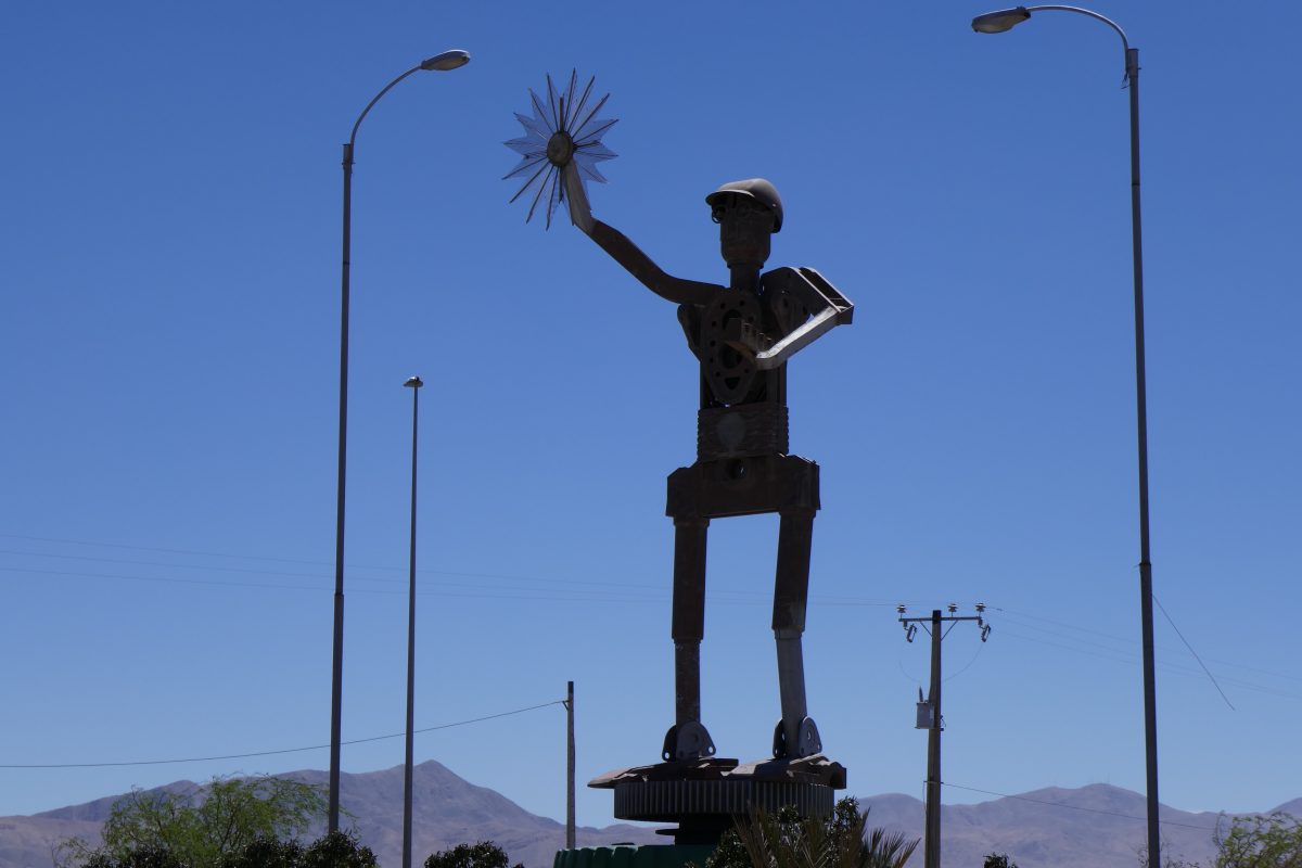
Arriving at Calama I was met by this statue:
Statue at entrance to Calama
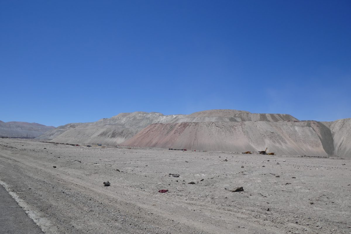
I continued on to Chuquimata but getting there I found that you could only view the mine on a guided tour. All you could see were massive spoil tips but not the hole in the ground which is 4.3 km long, 3 km wide and over 900 m deep. You can read about it here: https://en.wikipedia.org/wiki/Chuquicamata
I wasn’t going to hang around for a guided tour but FWIW here is one of the smaller spoil tips There’s a large truck at the base which gives you some idea of its scale:
Spoil tip at Chuquicamata
I headed back to Calama and picked up the road to San Pedro.
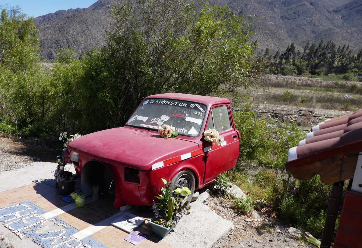
First thing that caught my eye was this impressive roadside shrine:
Roadshrine shrine outside Calama
I thought it was nice of his relatives to leave him a car so he could scoot about in the afterlife but then noticed they had removed the engine – maybe he wasn’t such a good driver. Anyway this got the roadside shrine of the day award.
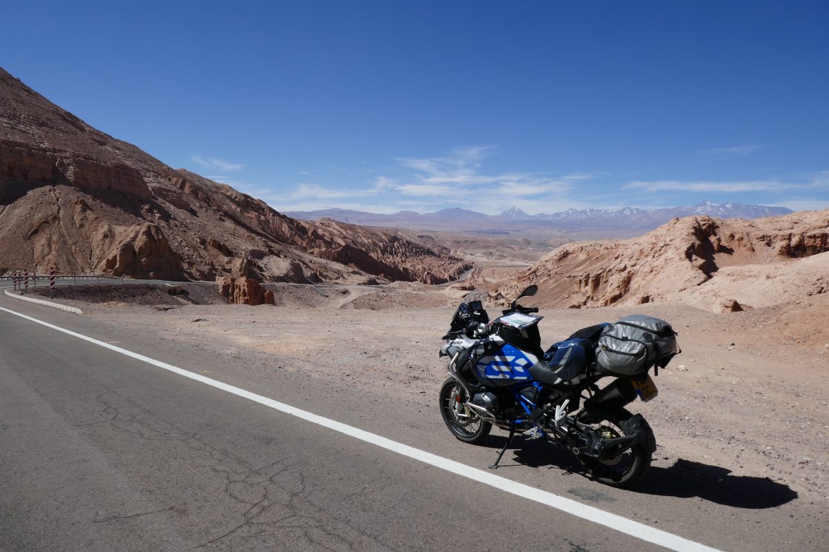
It was a tedious enough ride towards San Pedro but just before I got there I crossed through the Valle de la Luna and moonscape is probably a good description of this:
Valle de la Luna 25th SeptValle de la Luna 25th Sept
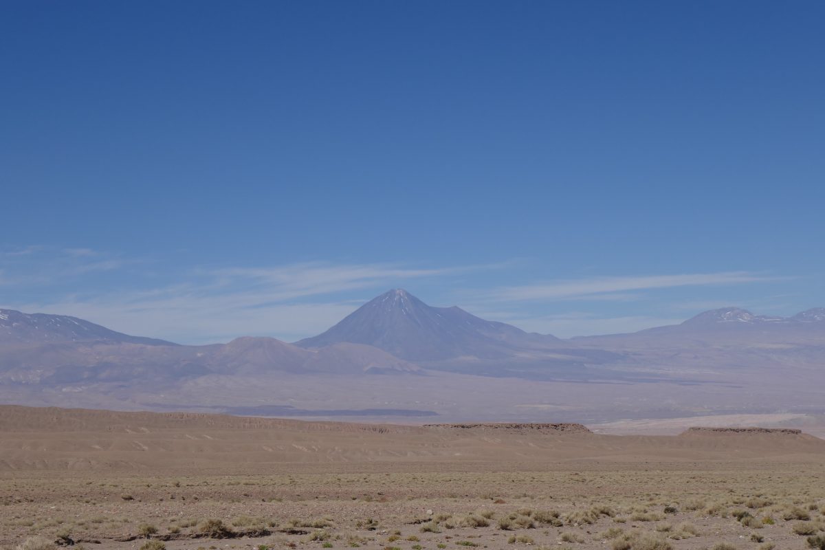
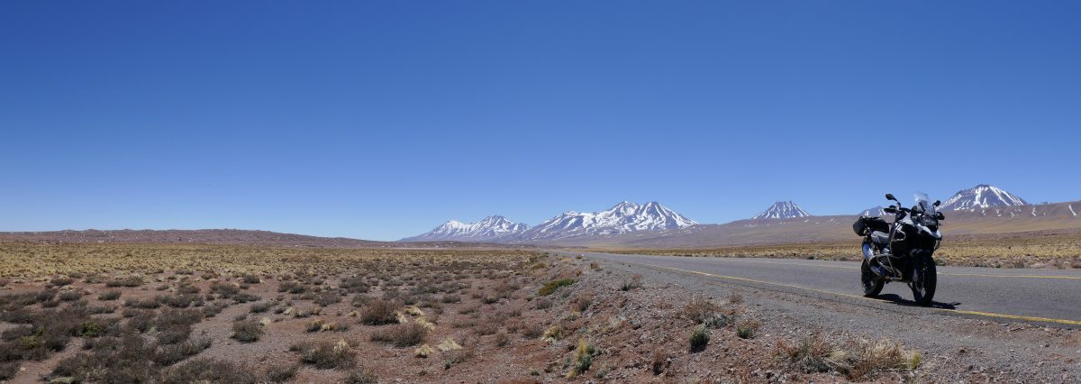
You could also see how much volcanic activity there had been. This is Cerro Juriques which is due east of San Pedro at 5,904m amsl.
Cerro Juriques 5,904m East of San Pedro 25th Sept
I eventually found my hotel – not listed as such in the Garmin map data – and found that it had the town’s only petrol station next door so that at least was convenient.
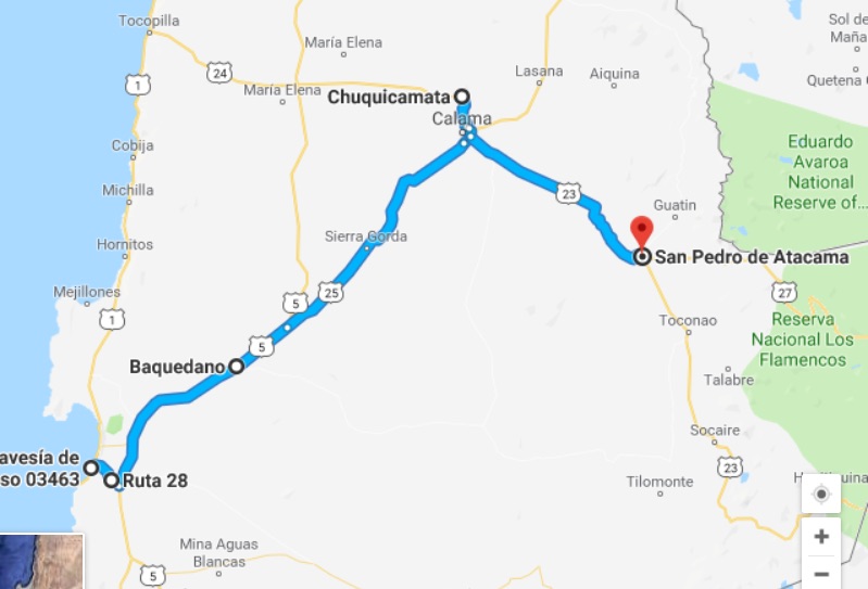
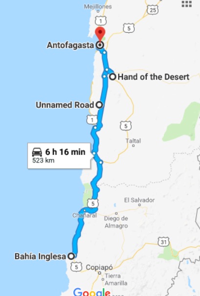
Anyway here was the route for the day:
San Pedro was a bit like Vicuna with the hippy backpacker vibe. Everything apart from the church is single story and virtually all made of adobe – essentially mud with straw mixed in. There were lots of shops selling tours to the various attractions but I don’t do guided tours so decided that the following day I would go and explore on the bike.
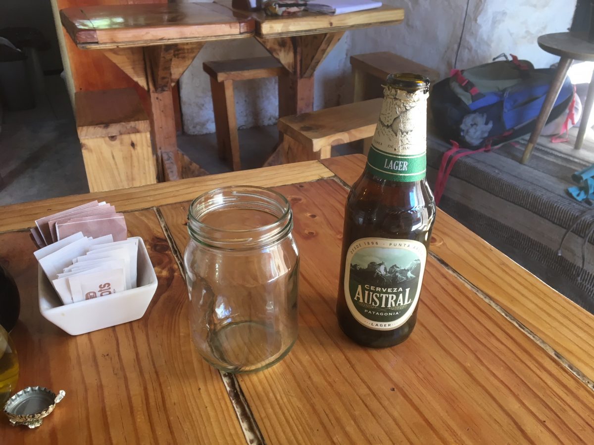
However, I felt like a beer and asked at the hotel bar for one. They informed me they didn’t sell alcohol! FFS a hotel that doesn’t sell even a beer. What was the world coming to? Anyway help was at hand at the Cafe Roots 50 metres outside the front gate:
Beer in San Pedro. Note the glass – sorry that should read jam jar
Looking at the map I could see three passes from San Pedro into Argentina, Paso Jama, which I knew was a paved road the whole way through to Argentina Route 9, Paso de Sico which the map indicated was paved to the Chilean border and a third pass about which I could get no useful information.
So the following morning I headed for Paso de Sico. After about 50 miles I reached the village of Socaire. The SatNav said the road didn’t go any further but I checked the settings and switched off the avoid unpaved roads and a road appeared on the device – as I knew it would because I could see a perfectly good tarmac road leading out of town. So off I went and it turned out to be a really good ride.
I had checked my altitude in Socaire and it said 3,200m. I hadn’t appreciated how much I had been climbing. This was my new altitude PB. Previously it has been Col D’Iseran in the French Alps which I had ridden a few times or Cime de la Bonette at 2,860m (but not a pass just a paved road).
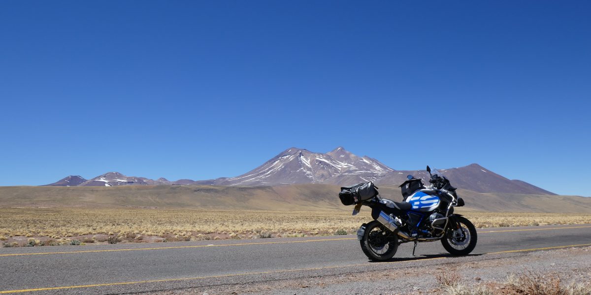
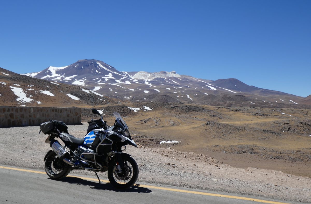
Continuing upwards I rode through what must have been the lava field from the extinct volcano above:
Lava field from Cerro Lejia, 5,793m
and I came out on I’d describe as a high plain:
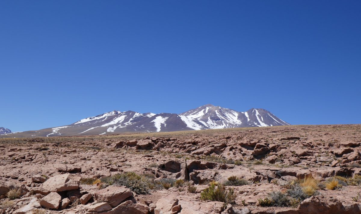
Ascending from Socaire at 3,900m with Cerro Lejia in the backgroundAscending from Socaire with Cerro Miniques 5,910m
The road was in good condition so I continued on
Ascending from Socaire, 3,907m amsl
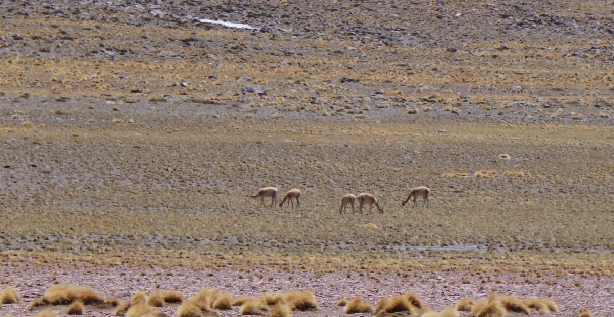
and spotted ny first vicuna – 6 of them grazing. This was a change from what I had ridden through on the way to Antofagasta which it got hotter the higher you went, and with zero vegetation. Here it got colder as you ascended but there was lots of growth and lots of evidence of animal life.
Vicuna beneath Cerro Miniques
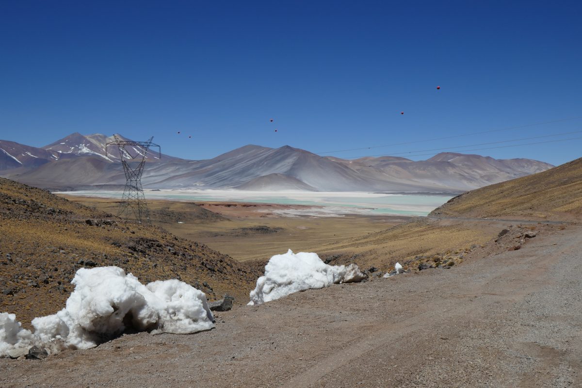
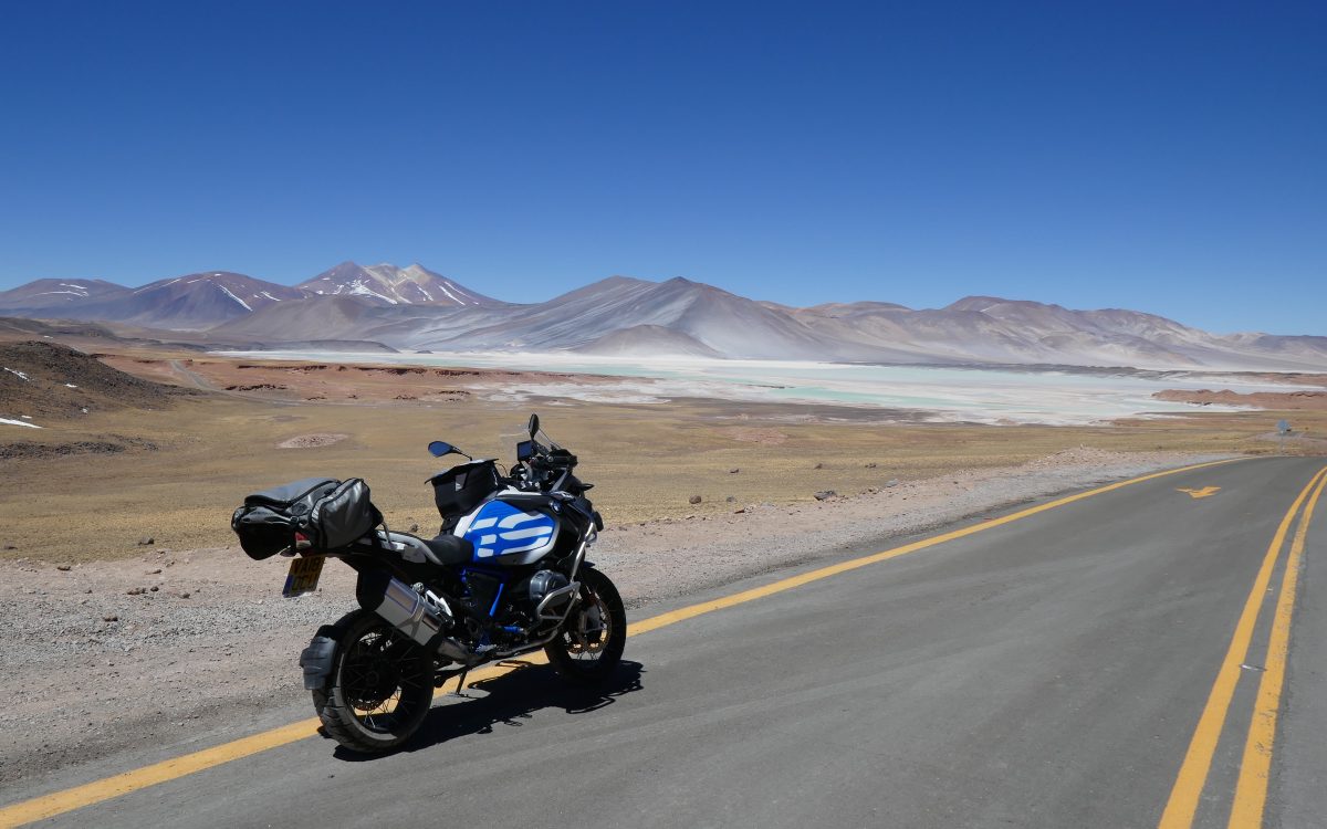
Continuing on I came across my first “Salar” or salt lake:
Salt lake on route 23 with snow in the foregroundSalt lake on route 23Looking back to Cerro Miniques
and further on I came to Laguna Tuyalto
Laguna Tuyalto
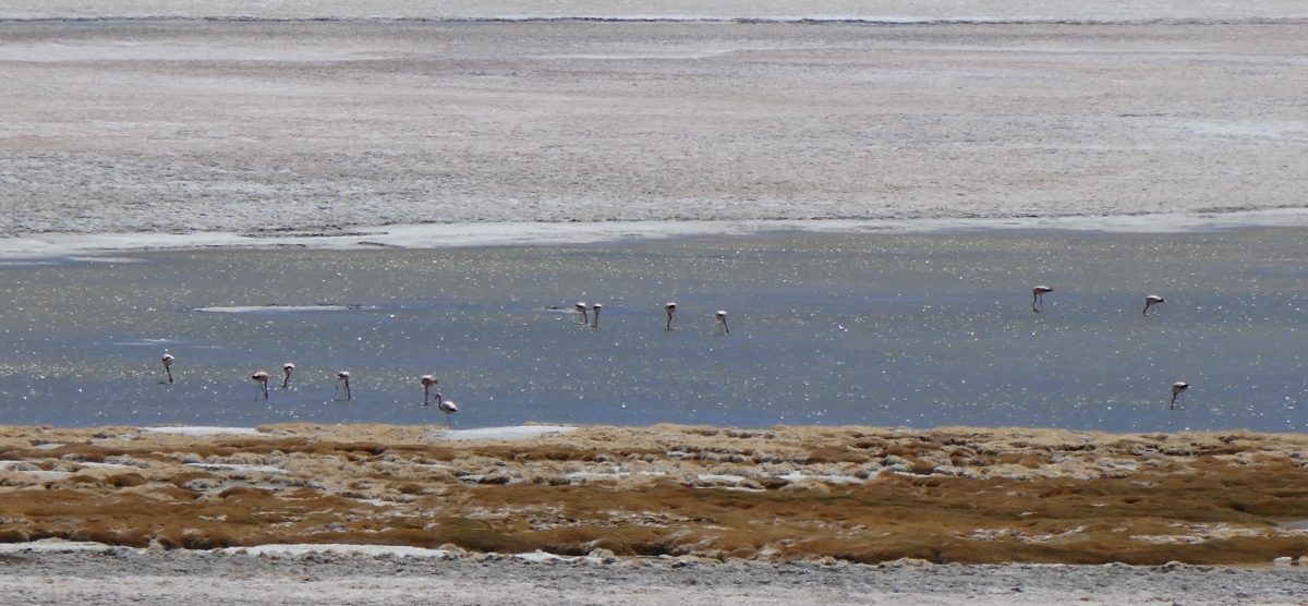
where there were flamingos
Flamingos at Laguna Tuyalto
There were numerous signs telling you to keep off the area surrounding the lake so apologies if the photos aren’t the best but take it from me they are Chilean Pink Flamingos
Flamingos at Laguna Tuyalto
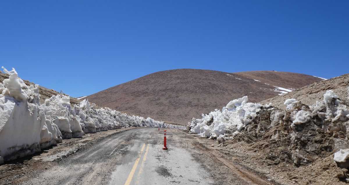
I continued on but a few miles down the road I was met with this:
End of the road for me at 4,297m amsl
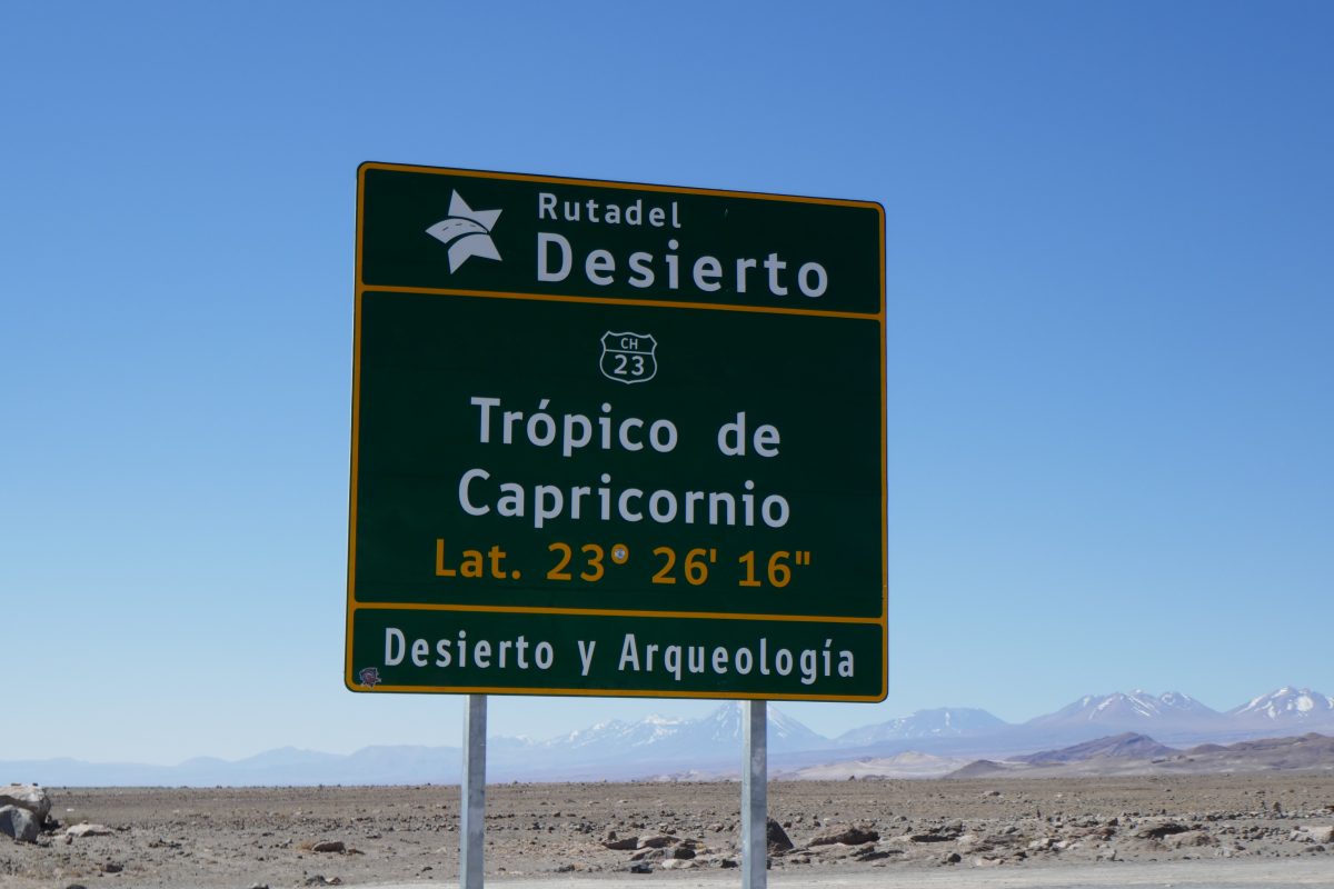
In fact the road was passable as a bus had stopped in Socaire heading this wayand hadn’t come back but I wasn’t going to take a chance on getting stuck. You could feel how relatively thin the air was and I didn’t want to drop the bike and find myself unable to get it upright. So it was time to turn around and head back. I’d ridden about 107 miles from San Pedro and took the same route back which involved me crossing the Tropic of Capricorn:
Tropic of Capricorn marker 26th Sept
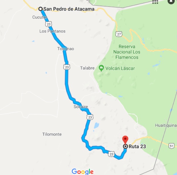
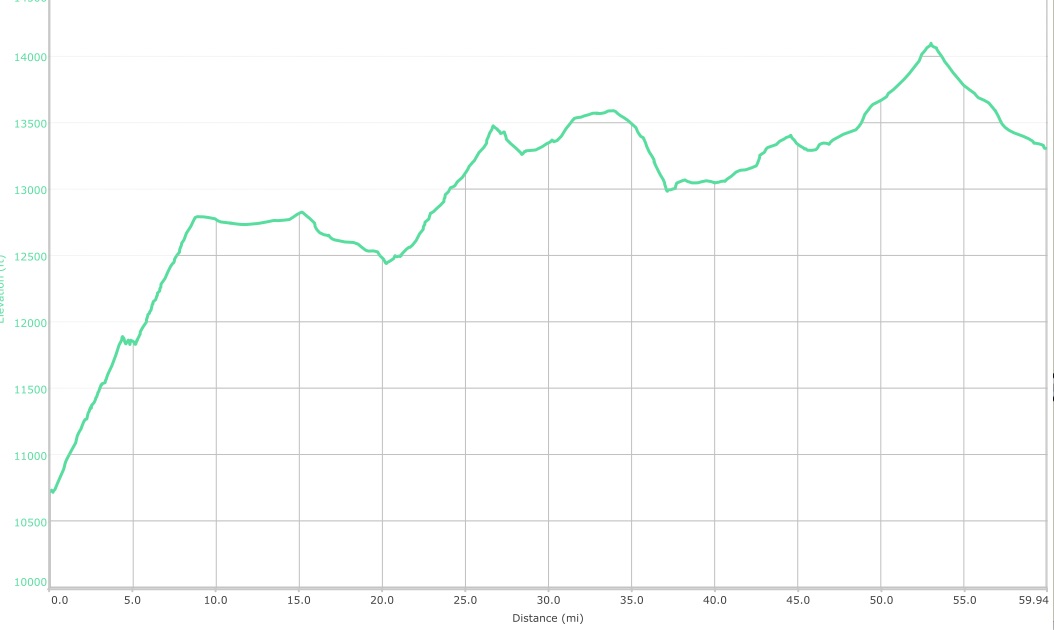
Here is the route for the day and the profile:
I filled the bike up back at base so I’d be ready to hit the road earlyish the following day. I would have about 375 miles to go across the Andes to Salta in Argentina.
I’ve spent the last 3 days heading North to get myself towards a position where I can cross into Argentina from San Pedro de Atacama.
Friday 22nd
I left Valparaiso on Friday, or rather I should say that I spent 30 mins trying to leave Valparaiso as the one way system and the steep narrow streets combined to get in the way. I thought I would try a more direct route but that was a mistake as I ended up in a dodgy neighbourhood with even dodgier and aggressive star dogs who seemed to think I was fair game. It was accelerating away from one such pack that I found out that you can get a GSA to wheelie – although Taj would have decried it as a feeble effort.
Anyway I eventually got on the main road out through Vina Del Mar and onto my route for the day which was to be as follows:
I was soon on Route 5 – the Pan American highway – and the main route to travel North to South and vice versa. It’s a toll road but the tolls for motorbikes are not high. I had an easy run through to La Mostaza where I decided to get off Route 5 and head inland to Illapel.
The turn is close to the ocean and the first thing that I noticed was an enormous sand dune about a kilometre inland:
Inland Sand Dune at La Mostaza
The road looked promising and so it turned out:
Just after La MostazaJust after La Mostaza
Poppies lined the roadside – very pretty
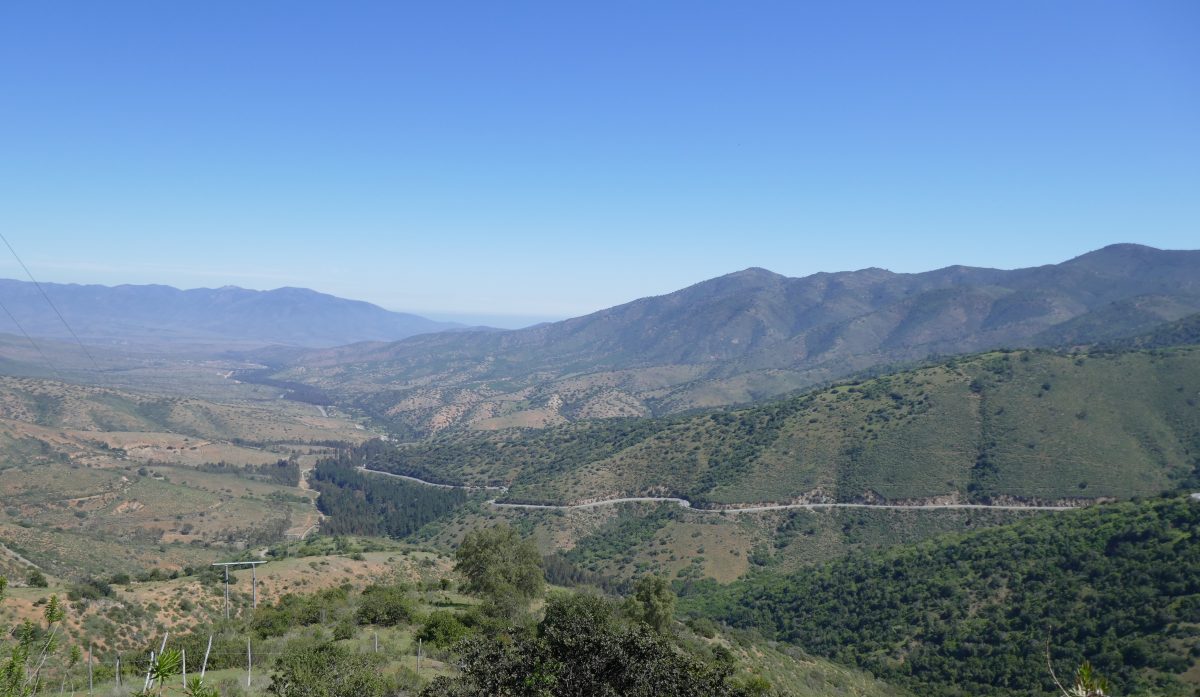
I then rode up a nice pass:
Between La Mostaza and IllapelD85 between La Mostaza and IlapelBetween La Mostaza and Illapel
and the descent was good as well
Between La Mostaza and Illapel
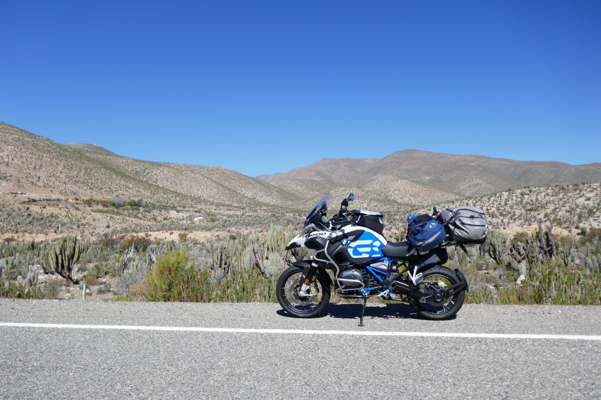
From Illapel I headed for Combarbala, which took me through the Chilean Nation Chinchilla Reserve – an inhospitable place for anyone as I couldn’t see what the poor little furry buggers would have to eat unless they liked cacti.
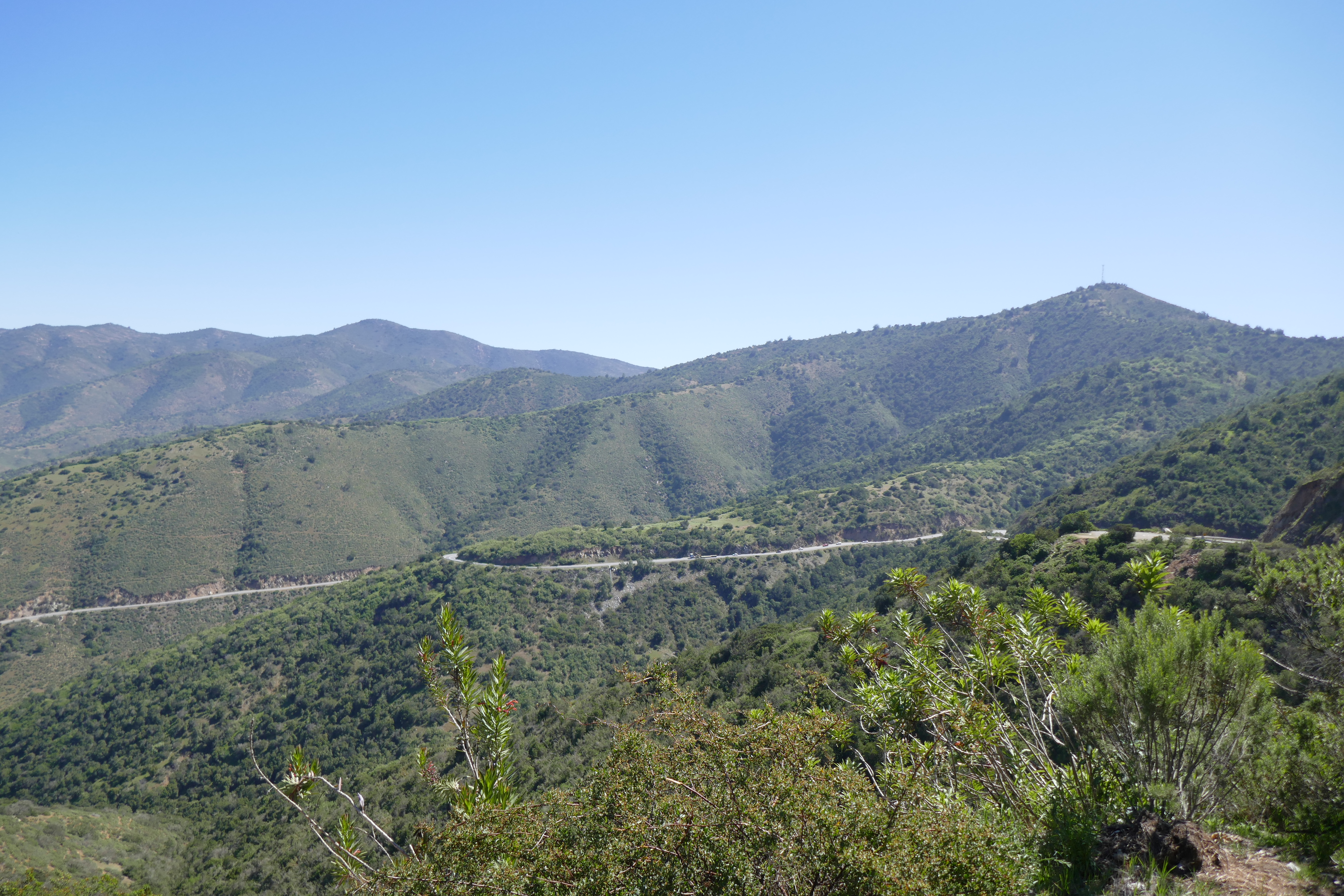
Through the reserve and I turned onto the D71 which was another good bit of road:
On the D71 between Illapel and CombarbalaOn the D71 towards Combarbala
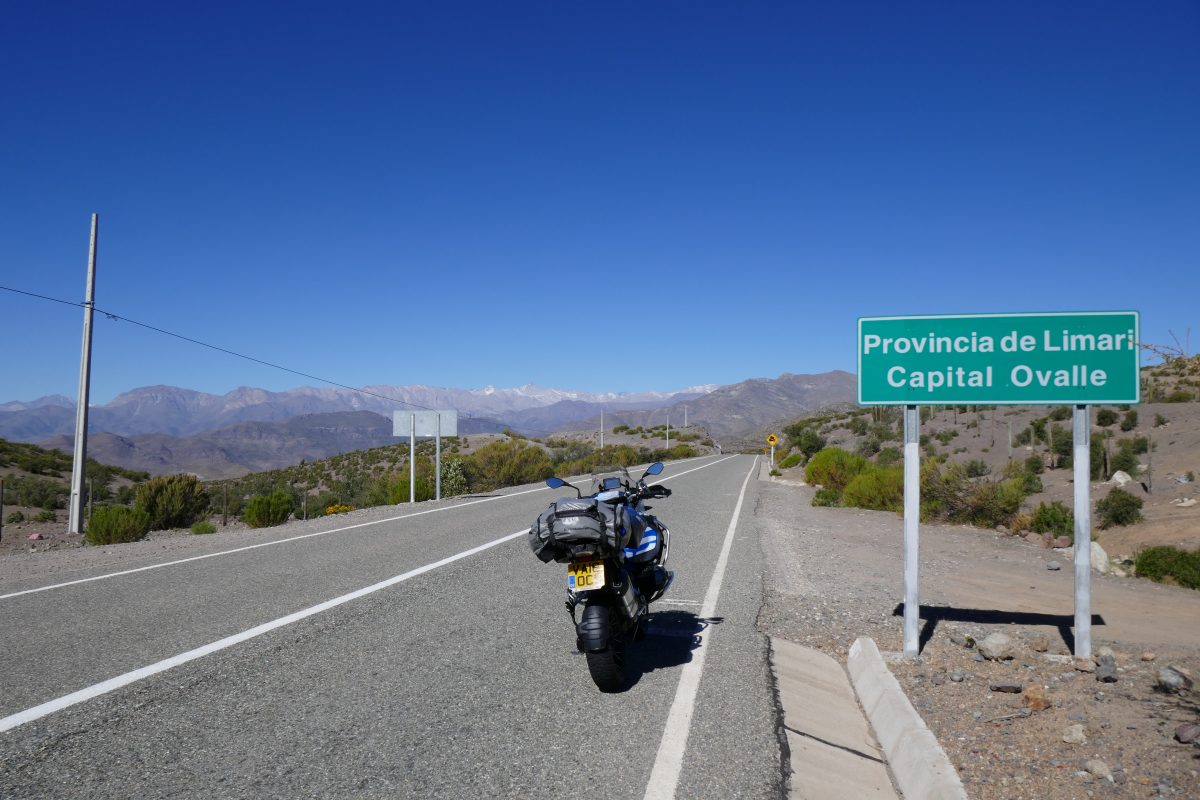
Through Combarbala and the next aiming point was Ovalle
Between Combarbala and Ovalle
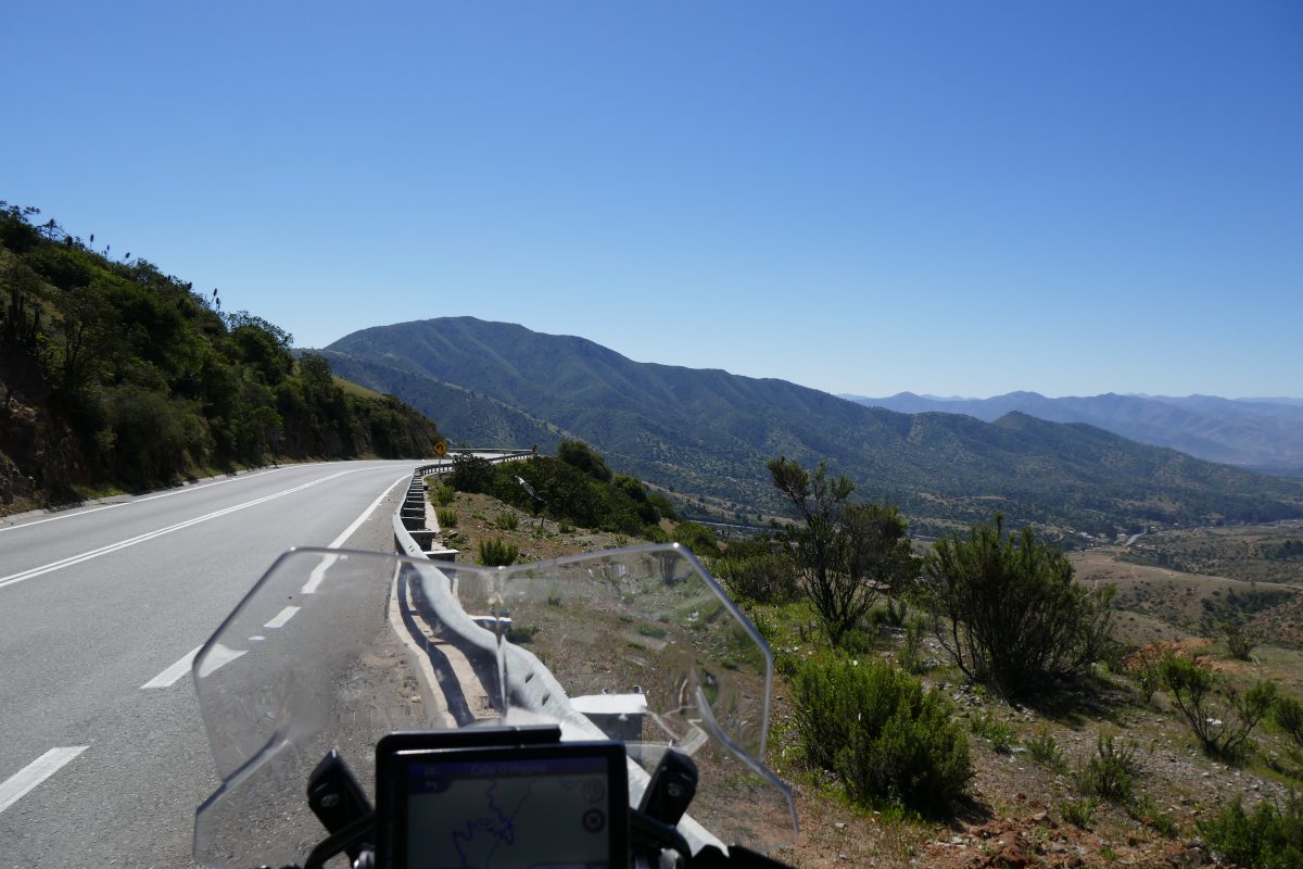
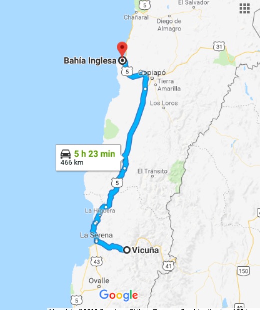
The road got tighter here and I found myself frequently running alongside a disused narrow guage railway but I eventually reached Ovalle and then had a decision to make as to which route to go to my destination at Vicuna. I’d looked at the map earlier and it indicated that broadly anything not coloured red or yellow was an unmade road and in fact just before the Chinchilla reserve the road ahead which was indicated as a main road had a sign “Pavimento Cerrado” – road paving finished – and was indeed a hard packed dirt road as far as the eye could see. So I chickened out and headed towards La Serena a large town on the coast. They had clearly just finished off a new toll dual carriageway but luckily for me hadn’t got round to installing any toll booths yet so I have a free run to La Serena when I took Route 41 all the way to Vicuna and my hotel for the night.
The hotel – Hysteria Vicuna – was Ok and the porter very kindly opened the padlocked gate into the garden and made space for the bike in a small summer house where it was out of sight.
Saturday 22nd
I half debated staying on in Vicuna as it’s the gateway to Paso Agua Negre which at 4,755m is the highest pass between Chile and Argentina, but which I found out was officially closed, although others had said it was open. I thought I’d leave that to the return journey so headed back to La Serena before heading North once more.
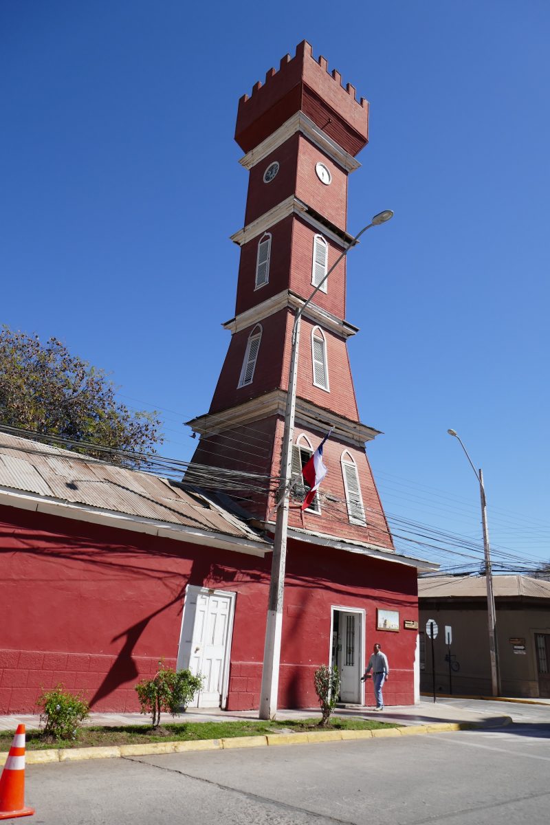
Vicuna is a pretty small town and bills itself as the centre for astronomy since there are lots of observatories on top of the high mountains which surround it. It has a hippy backpacker vibe to it and there were lots of hippy backpackers around to prove the point. I only took one photo though of its rather quaint church on the main square:
Church in Vicuna
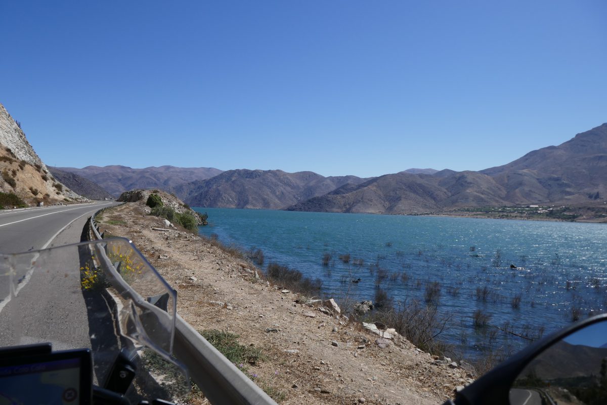
You pass a large reservoir just South of Vicuna:
Reservoir below VicunaReservoir below Vicuna
A little further on I stopped to look at one of the many hundreds of roadside shrines you see alongside virtually every road:
Roadside Shrine between Vicuna and La Serena
There are always photos of the departed but why half a car? Was it his favourite car? I saw one in La Serena which had a photo of a young boy and there was a twisted bike attacked to the wall above his photo. Was he killed riding it? Weird. If anyone has an explanation let me know.
Anyway from La Serena it was once more onto Route 5.
I came to a point where I knew from the Sat Nav that the road was about to head inland and there was a pretty fishing village – Las Hornos – right by the road. It was about lunchtime and as I’d had one piece of toast as the breakfast promised at the hotel seemed to have done a disappearing act I thought I’d stop off:
Los HornosLos HornosLos HornosView from Los Horns
and the restaurant where I had some delicious fresh fish
Lunch stop off Route 5 at Los Hornos
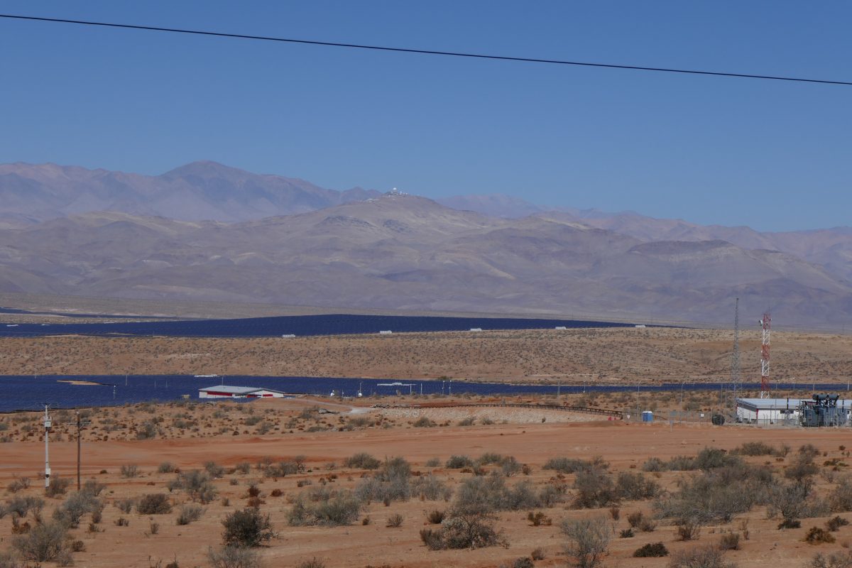
From there it was straightforward run up Route 5 to Copiapo. But before Vallenar I noticed the observatory at Cerro La Silla off to the right and there was a massive solar panel array just off the road:
Solar panels by Route 5 with the Observatory on the skyline
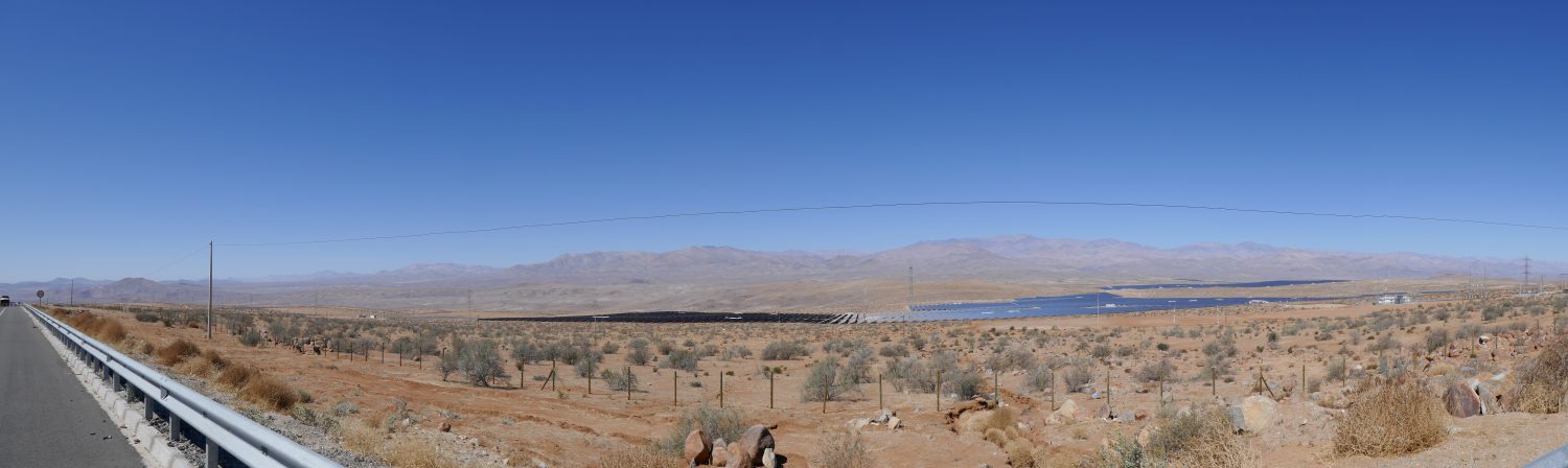
and a panoramic view from the same spot
Panorama on Route 5 with the solar panel array and the Observatory on the skyline
From there Route 5 took me virtually all the way to Bahia Inglesa, near Caldera where I’d booked a hotel. After the obligatory avoiding the stray dogs routine – the trick is to aim at them and they seem to get the idea that it’s good to get out of the way – I eventually found the hotel. I’ve never been to a place which so failed to meet the description on the booking.com website. Tanya asked me whether it was a s**thole and I said that would be an affront to s**tholes the world over. I just said that I’m cancelling my reservation and rode out. That did leave me with the need to find somewhere to stay but I just stopped at the first set of Cabanas I came to and they had one – at half the price of the other – and it was OK. Shower worked and no bed bugs – result.
This was my route for the day:
A few drinks at a local bar and I decided all was good.
Sunday 23rd
The aim for Sunday was to get to Antofagasta. It was my first real day in the Atacama desert which you may not know is the driest place in the world bar Antarctica. It less than ½ an inch of rain a year. I noticed the landscape changing as I approached Caldera the evening before – much more sand about.
Leaving Caldera I was back on Route 5 which followed the coast all the way to Chanaral. I think rugged is the description I would use of the coastline. Reaching Chanaral there were signs of how the ore mined inland used to get to the ports to be loaded onto ships – by train- but those days are long gone. The ore is mostly crushed, water added to turn it into a slurry then piped from the mine to the coast where the water is removed and the ore loaded onto the ship. There was a ship which looked as if it was being loaded in the harbour:
Chanaral Harbour
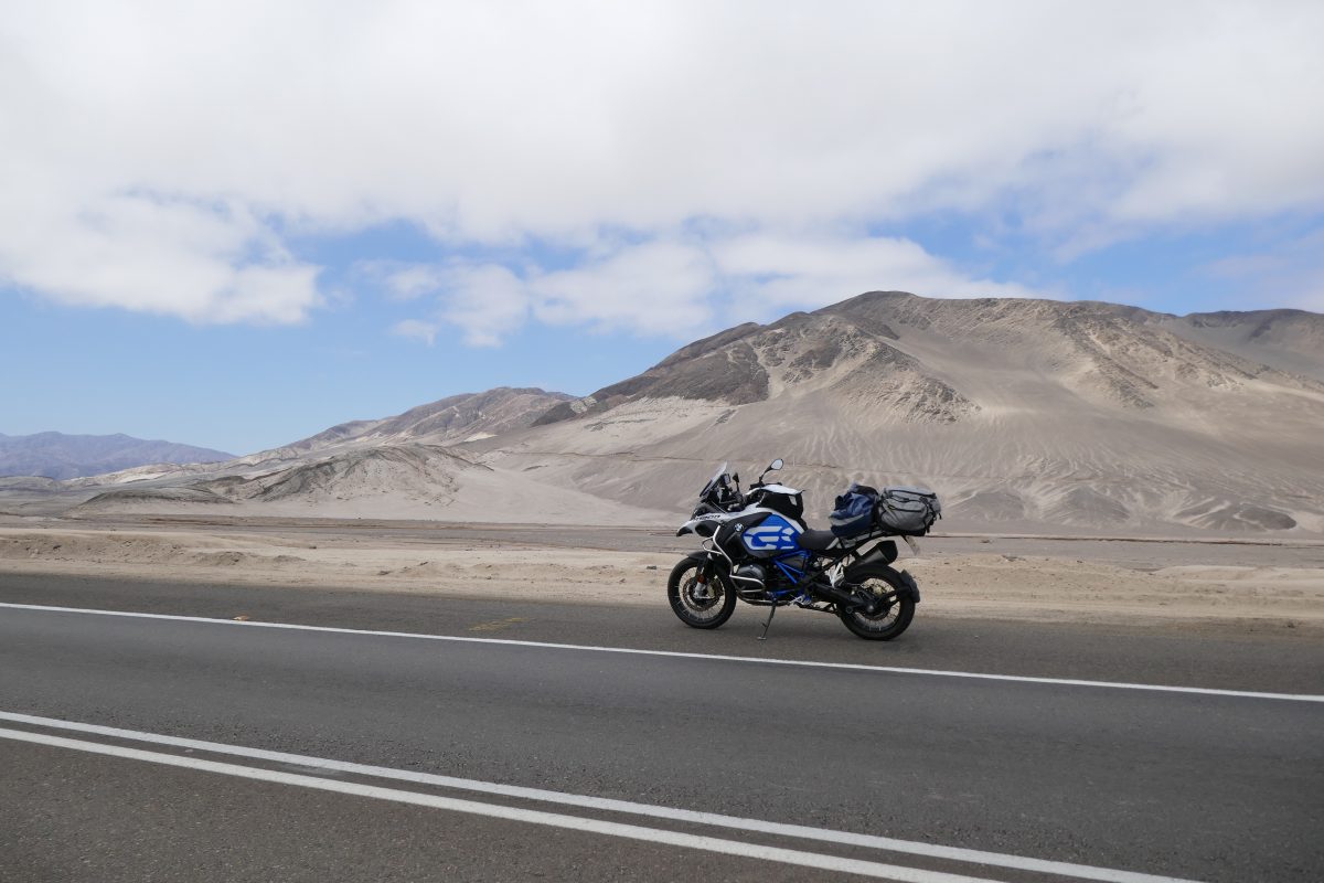
After Chanaral you are straight into what is unmistakably desert. These photos were taken a few miles after leaving the town:
Route 5 after ChanaralRoute 5 after ChanaralRoute 5 after Chanaral
It looks a bit boring but for me it was a nice change The different hues as you travel along. And not a single living animal for maybe 50 miles except for some buzzards. I had the option of staying on Route 5 which would take virtually all the way to Antofagasta but I turned off left on route 1 to Taltal.
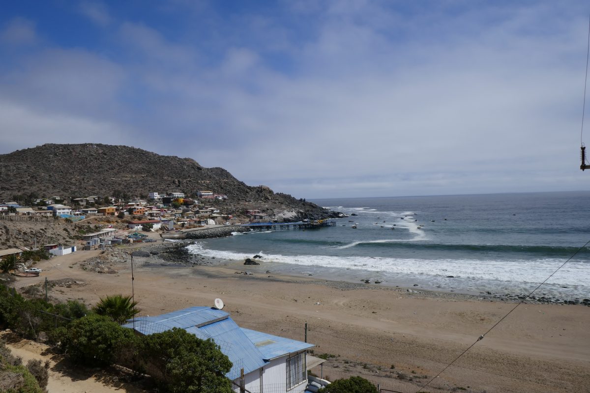
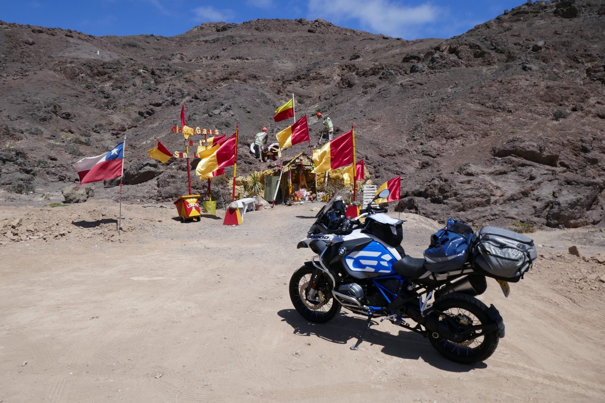
Taltal’s a pretty little fishing village that used to be a mining town. Just before town another roadside shrine caught my eye:
Roadside Shrine of the Day at Taltal
This one was dedicated to San Lorenzo and I decided to initiate my roadside shrine of the day competition and this was the first winner. Others will be announced in due course.
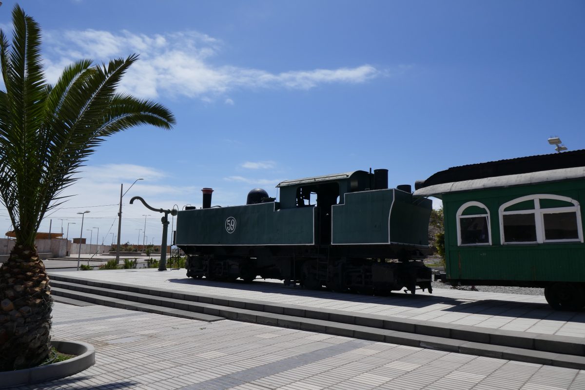
Into Taltal and here was a reminder of what used to haul ore:
Old Train at Taltal
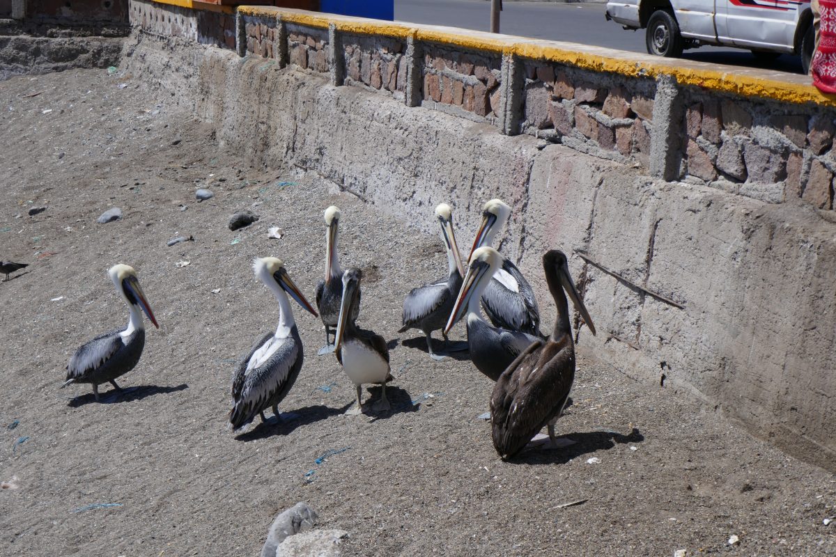
I rode down to the Harbour and made the acquaintance of a local riding a GSA. He told me he’d ridden down from Chuquicamata where he was a contractor working at the mine there – one of the world’s largest opencast Copper mines in the world. He was chomping on an empanada – a South American Cornish pasty – which he said was good -and I have to say that for about £2.50 the seafood variety – empanada marisco – was very good. So much so that a few of the locals were queuing up for scraps:
Pelicans hoping for scraps from the Empanada stall at Taltal
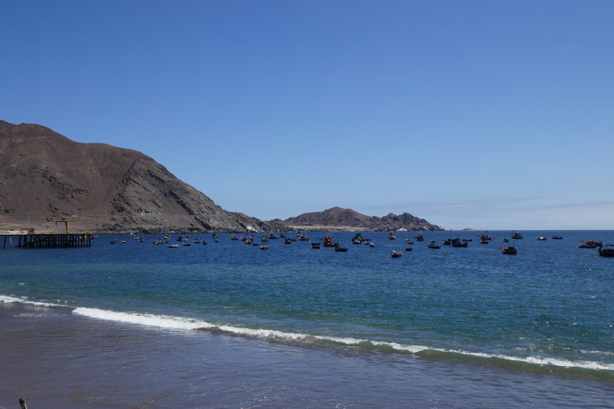
It was a pretty sight:
Taltal harbourView from the beachfront at Taltal
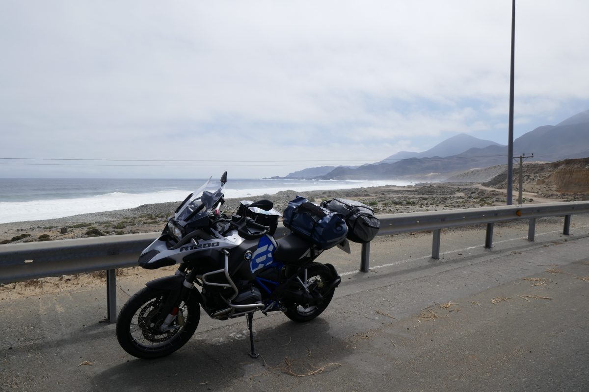
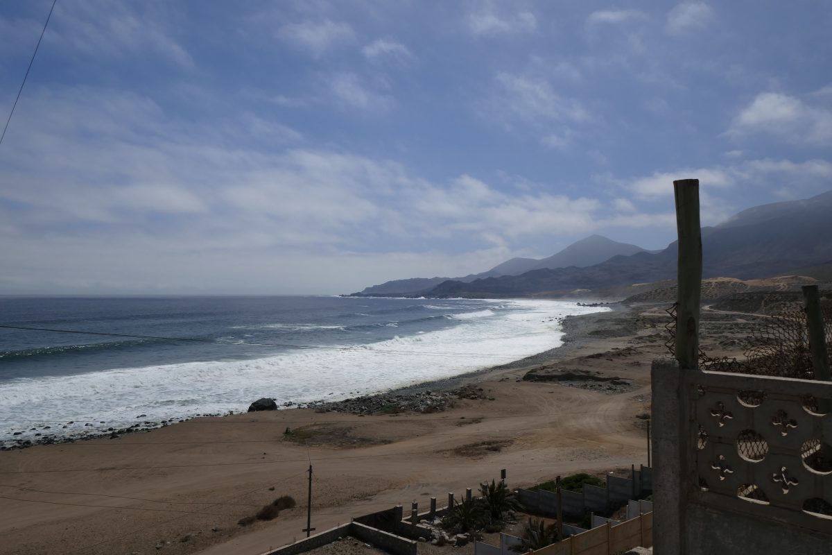
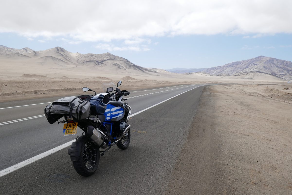
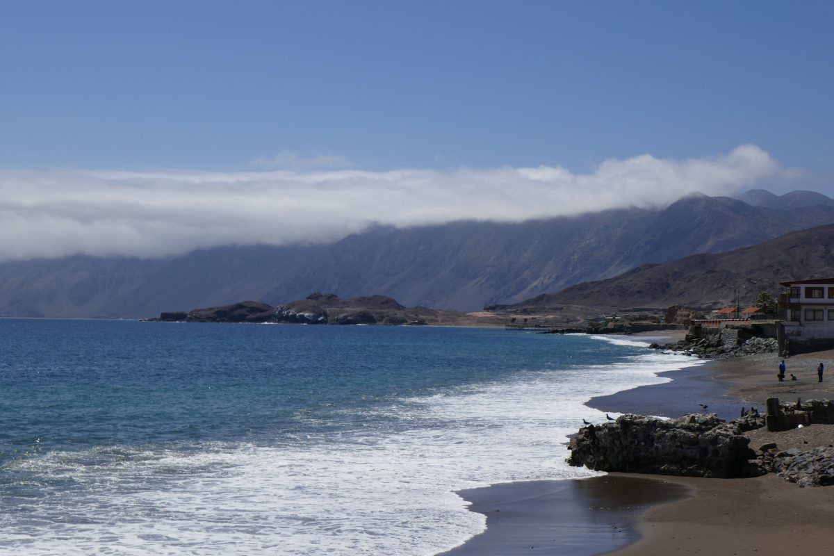
I set off North again towards Paposo. The road hugged the coast and was enjoyable:
Route 1 after TaltalRoute 1 after Taltal
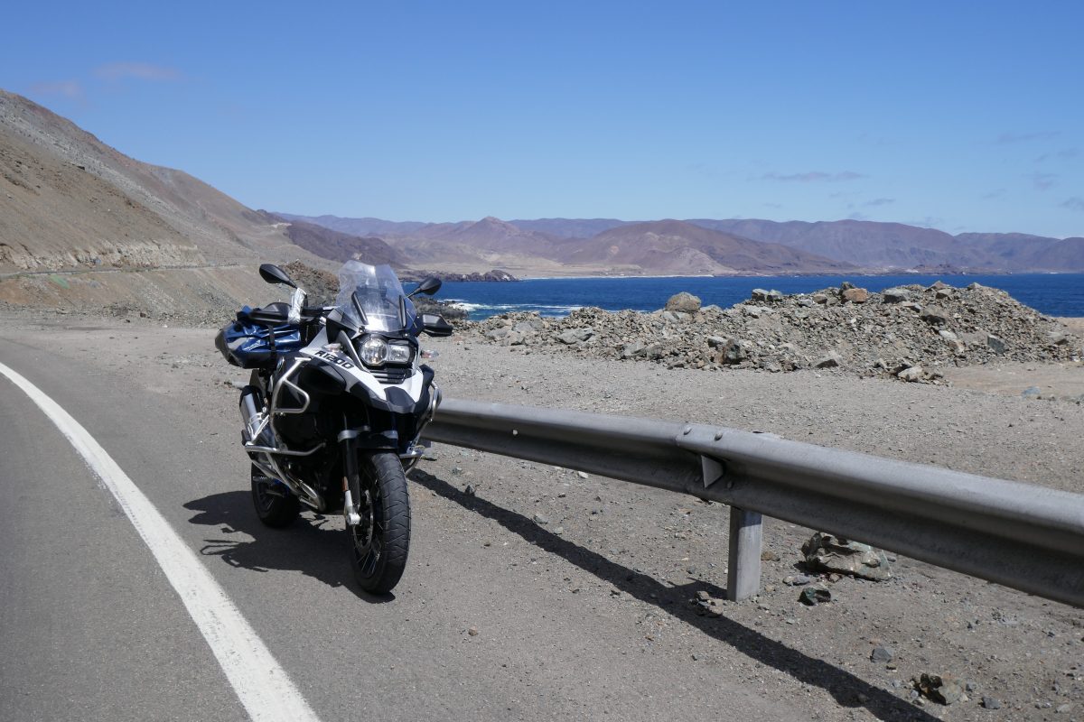
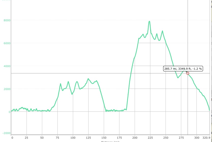
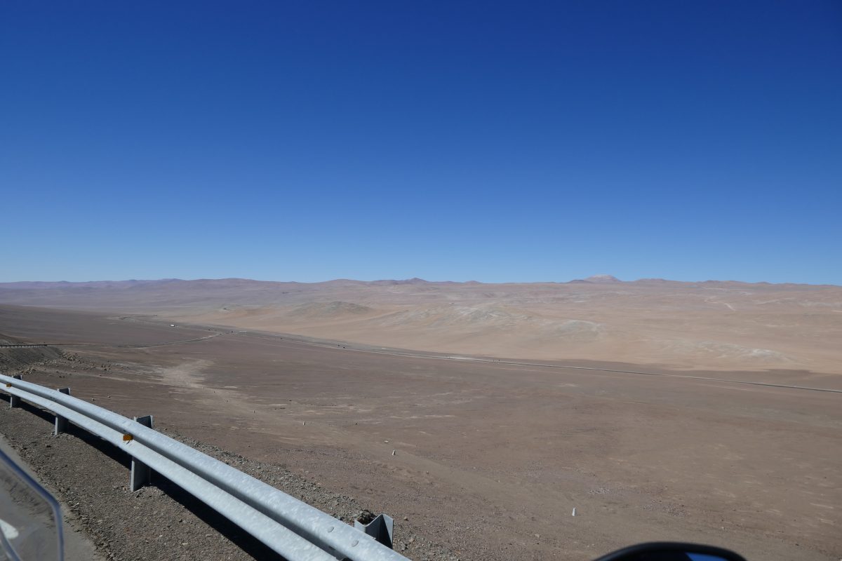
At Paposo I could have continued along the coast road but decided to head back inland on the main road signposted Antofagasta. This was fun – for about 15 miles the road just climbed and climbed, bend after bend after bend, until we got up to about 7,000 feet plus. If you have a look at the profile the first high bit is the road between Chanaral and Taltal and the second high bit is the road from Paposo:
Once I’d reached the plateau is was a rerun of the previous section only higher. The only odd thing I noticed was that the higher I got the hotter it got. Thus at sea level it was down to 16c. On top it was ranging between 28 and 32. The same applied as I approached Antofagasta – as I dropped towards sea level the temperature dropped with it.
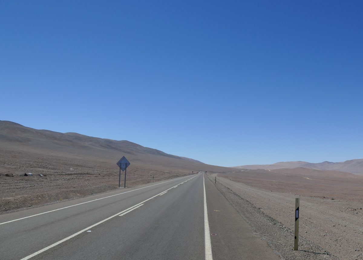
Route 1 after PaposoRoute 1 after PaposoRoute 1 after Paposo
The road seems endless at times:
Route 1 after Paposo
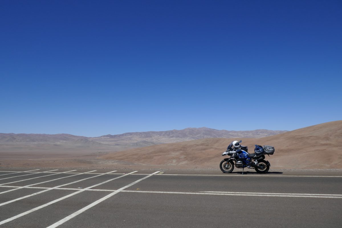
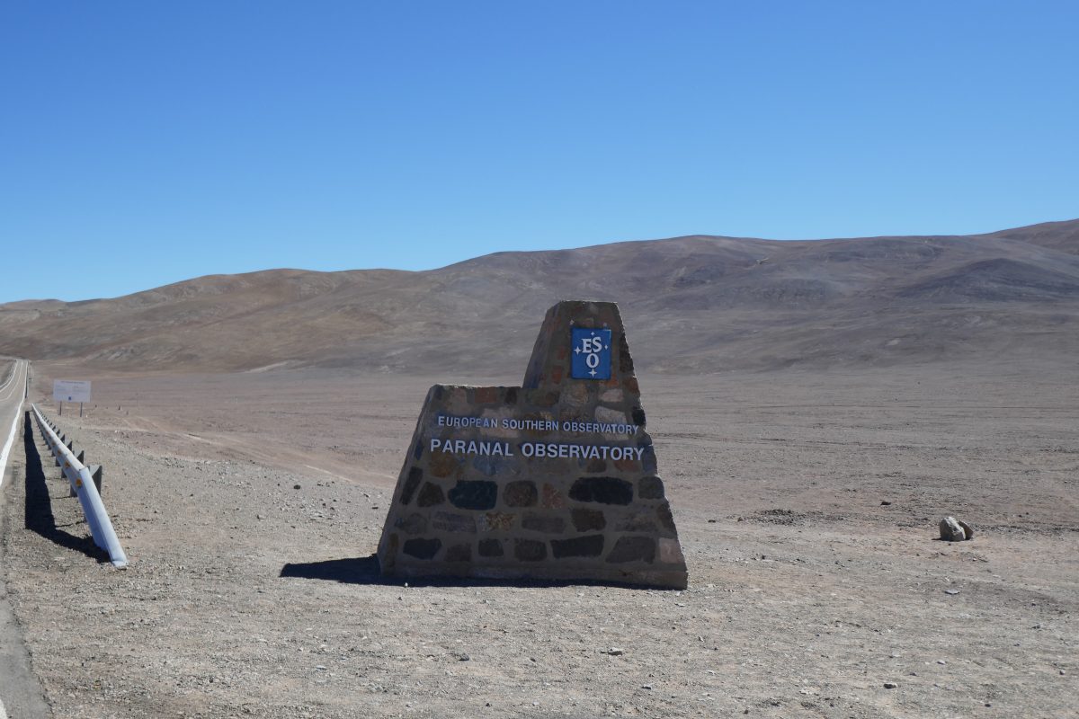
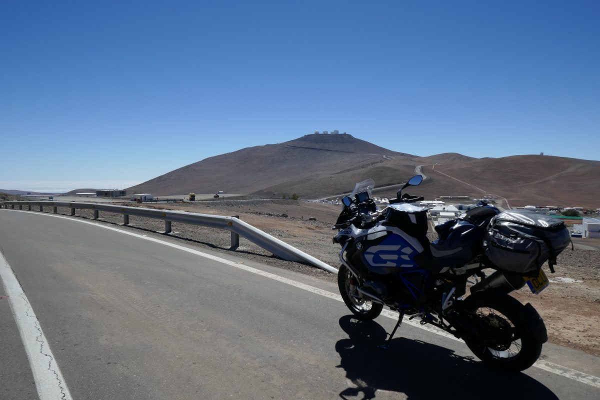
I knew there was an observatory nearby from the map – the Panaral and soon I saw the sign and there was a paved road up to it:
European Southern Observatory at Paranal off route 1Paranal ObservatoryParanal Observatory
At this point I was just under 8,000 feet up
They have an airstrip right by the main road presumably to ferry the boffins in and out. You can see it in this photo form the descent:
Descent from the Paranal Observatory
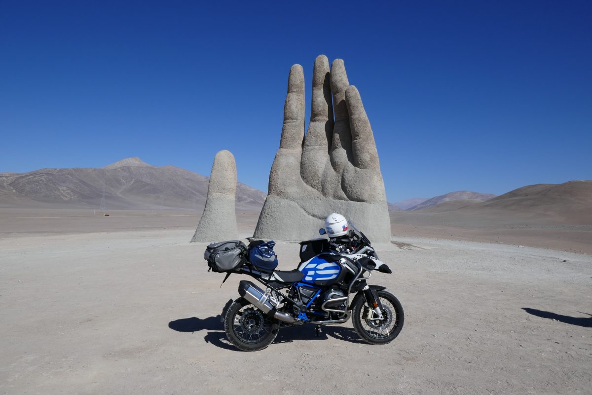
From there it was a straight forum down to rejoin Route 5 but instead of turning left and heading straight for Antofagasta I turned right as I calculated that the sculpture Mano del Desierto – the hand of the desert couldn’t be more than 10 miles up the road.
Wikipedia has this to say about it:
“The sculpture was constructed by the Chilean sculptor Mario Irarrázabal at an altitude of 1,100 meters above sea level. Its exaggerated size is said to emphasize human vulnerability and helplessness.The work has a base of iron and concrete, and stands 11 metres (36 ft) tall. Funded by Corporación Pro Antofagasta, a local booster organization, the sculpture was inaugurated on 28 March 1992.”
Anyway here it is:
Mano del Desierto off Route 5
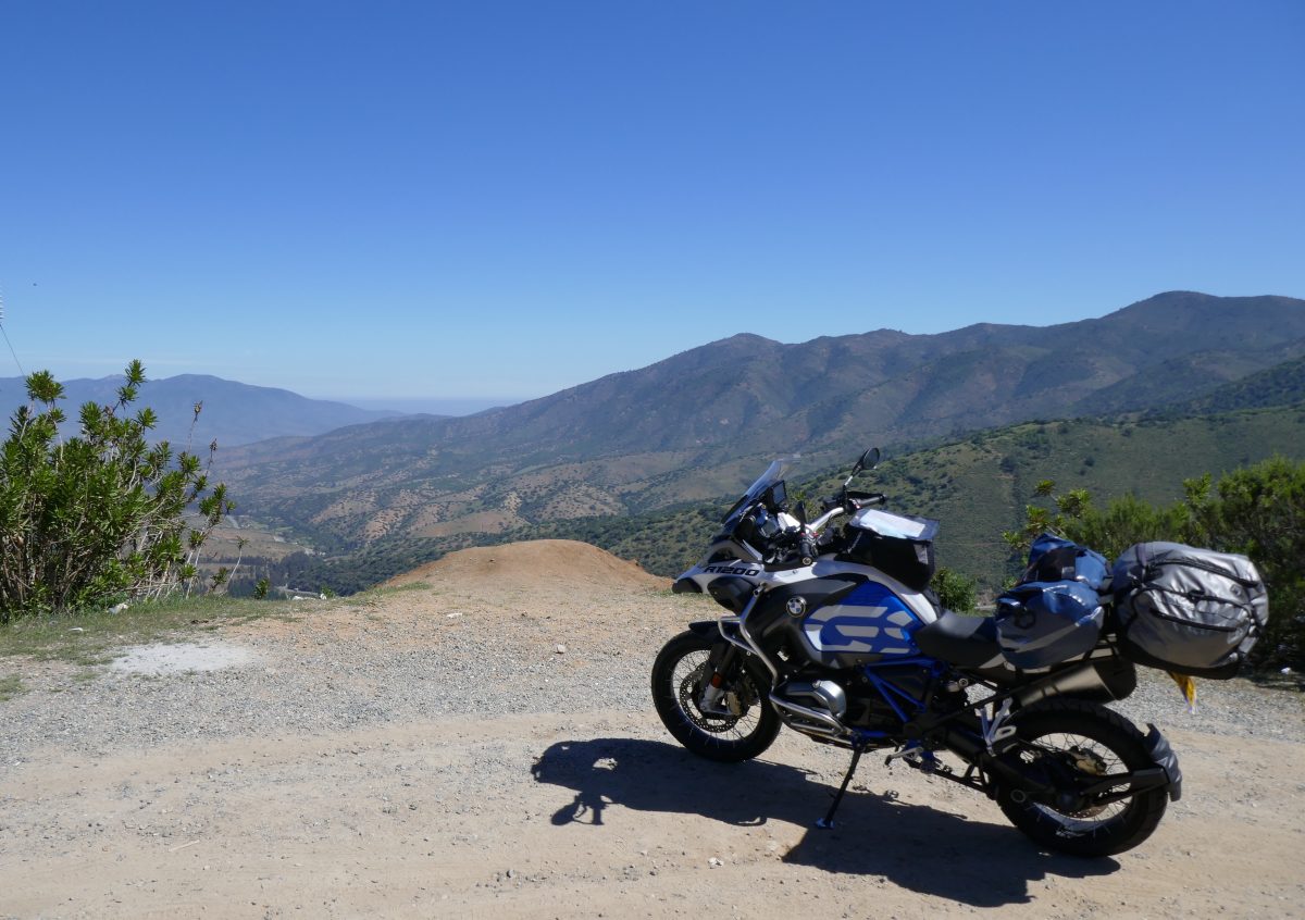
Anyway obligatory tourist bit over I headed for Antofagasta and my hotel. This was my route:
I was intending to pick the bike up last Monday – 17th – but it transpired that everyone was taking the day off because the 18th – Tuesday – was Independence Day, and because they would all be Piscoed, they would be taking Wednesday 19th off as well.
The extra time in Santiago wasn’t entirely wasted. I had managed on the Saturday to find this motorcycle shop: mototecknik chile in Las Condes. They turned out to be the Touratech agent for Chile, and they were able to sell me a puncture repair outfit and a pump which would run off the battery or BMW power outlet.
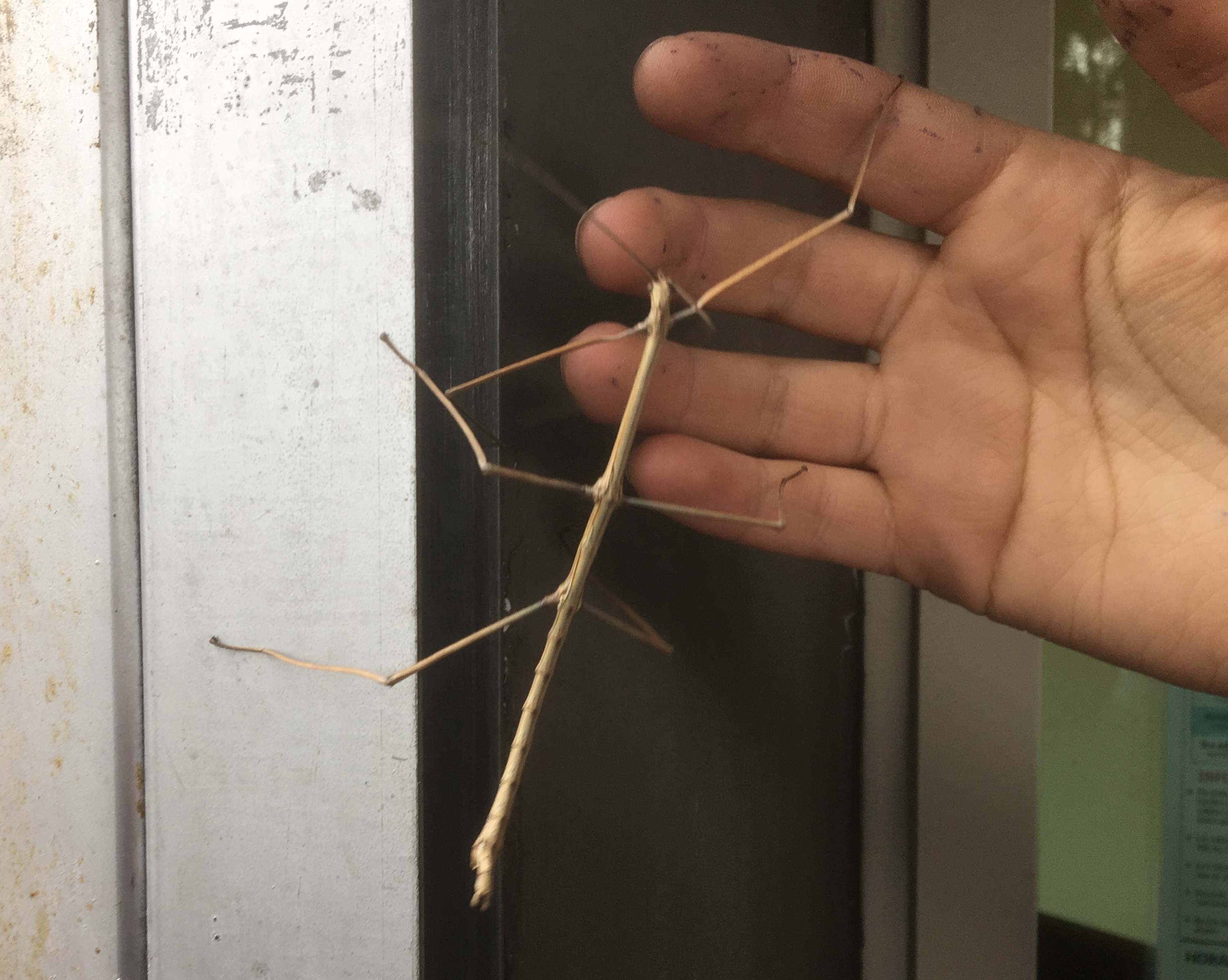
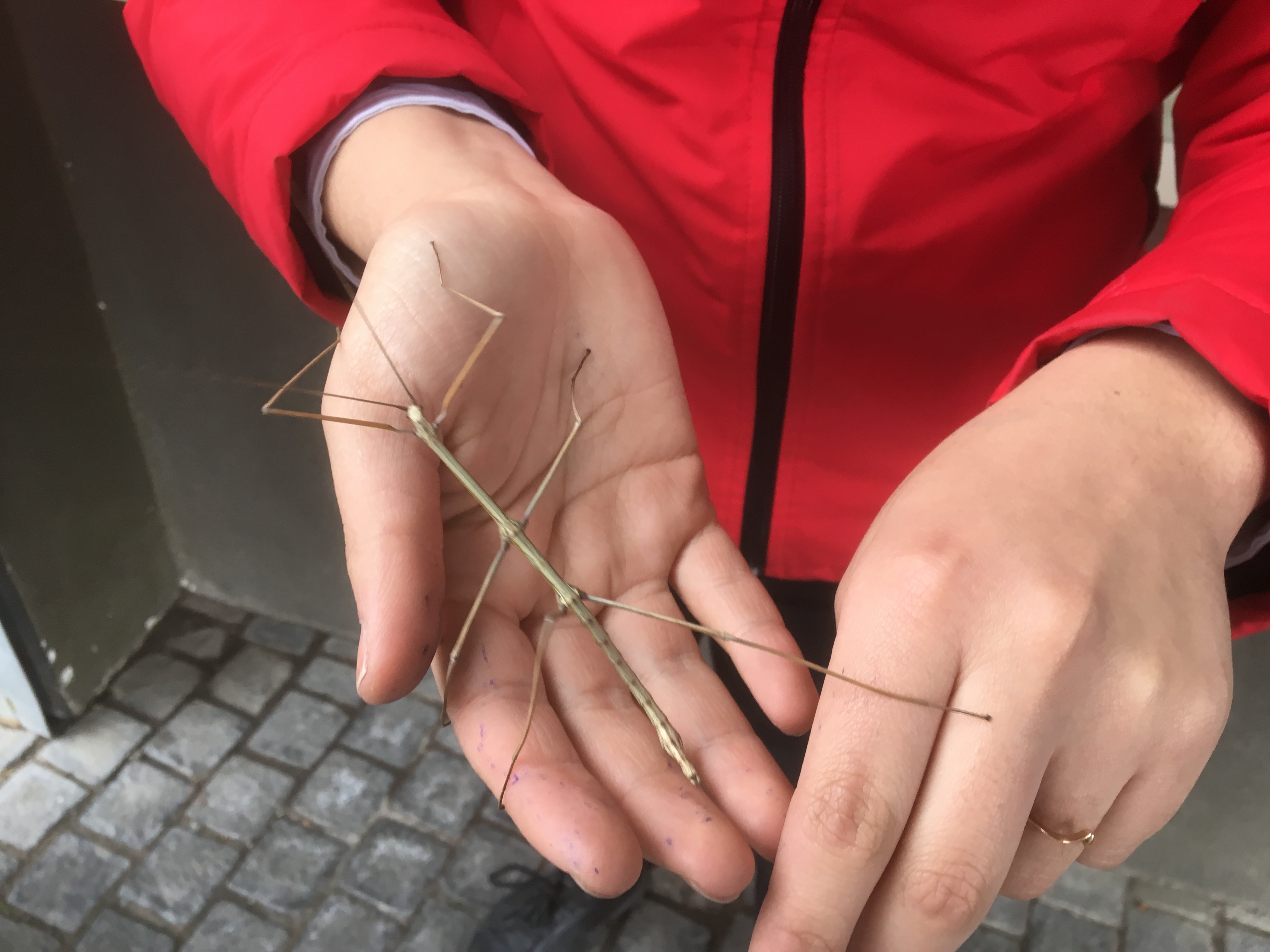
Still I had 3 additional days to kill and apart from having the odd Pisco myself I walked around a lot and also walked up San Cristobal, a hill above the Bellavista area just across the river from the hotel. It was a nice walk but I thought I’d take the last section on the Teleferico – gondola to you and me. At the ticket office the girl who manned it was showing off a stick insect which she picked off a neighbouring tree – first time I’d ever seen one in the flesh, not that it had much flesh on it:
A stick insect on the Teleferico, santiagothe stick insect again
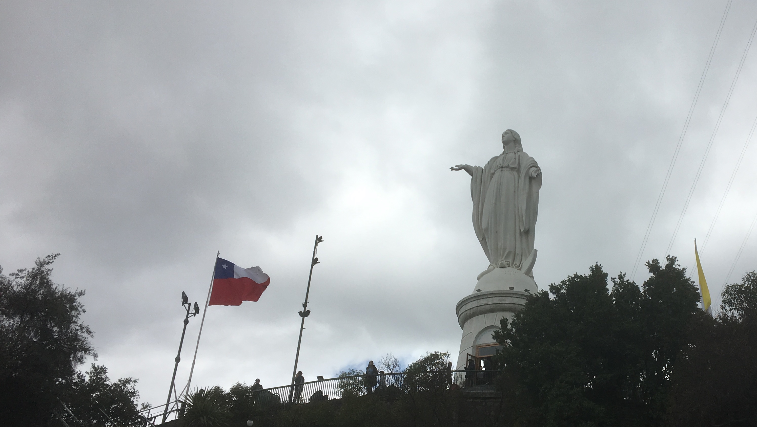
Then it was onto the top where being a Catholic country you had the obligatory statue:
Statue of the Immaculate Conception
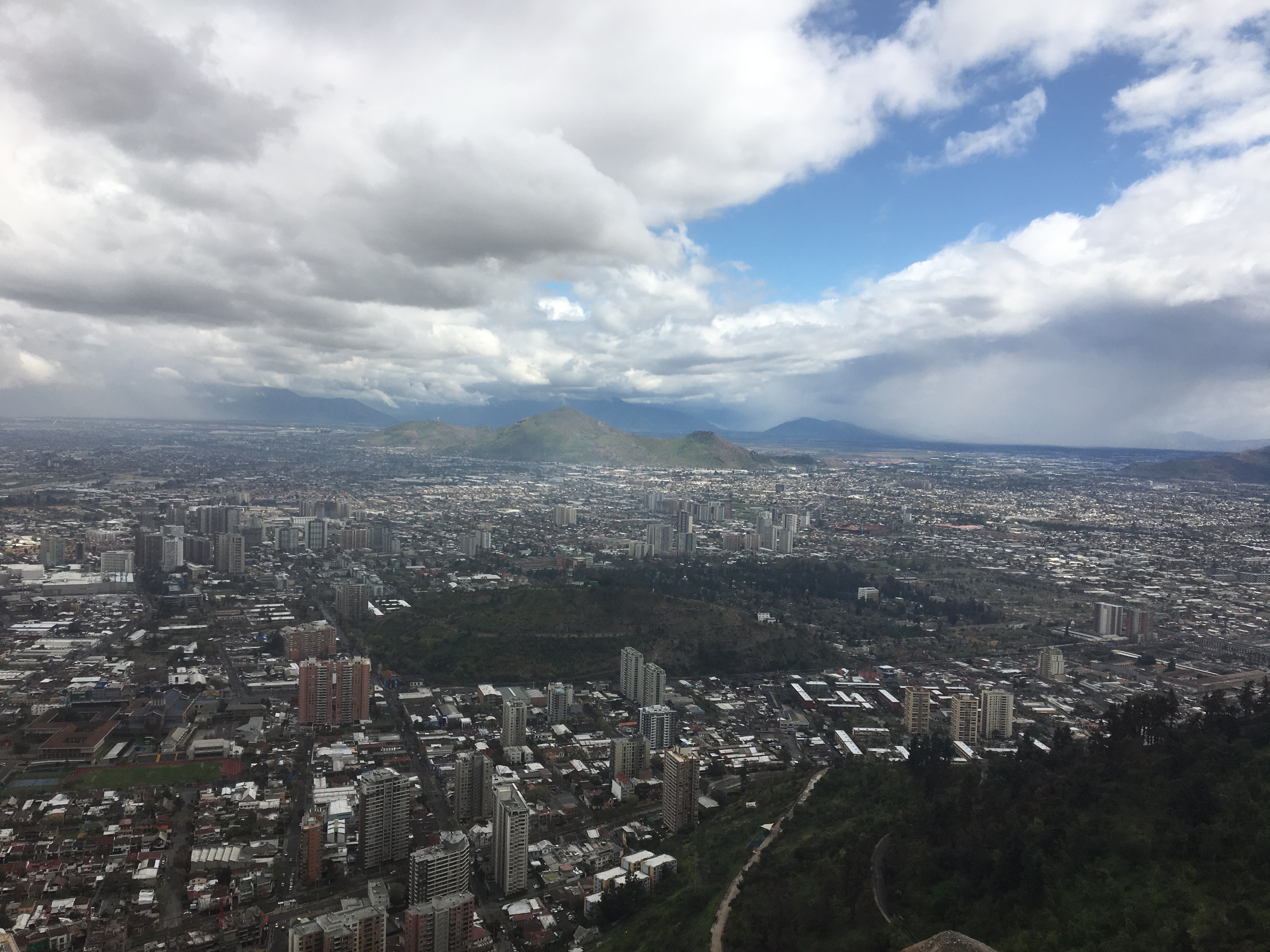
and lots of people selling religious type baubles. But the view was good:
Santiago from San Cristobal
and you could see why Santiago has a problem with smog – it sits in a bowl surrounded by hills.
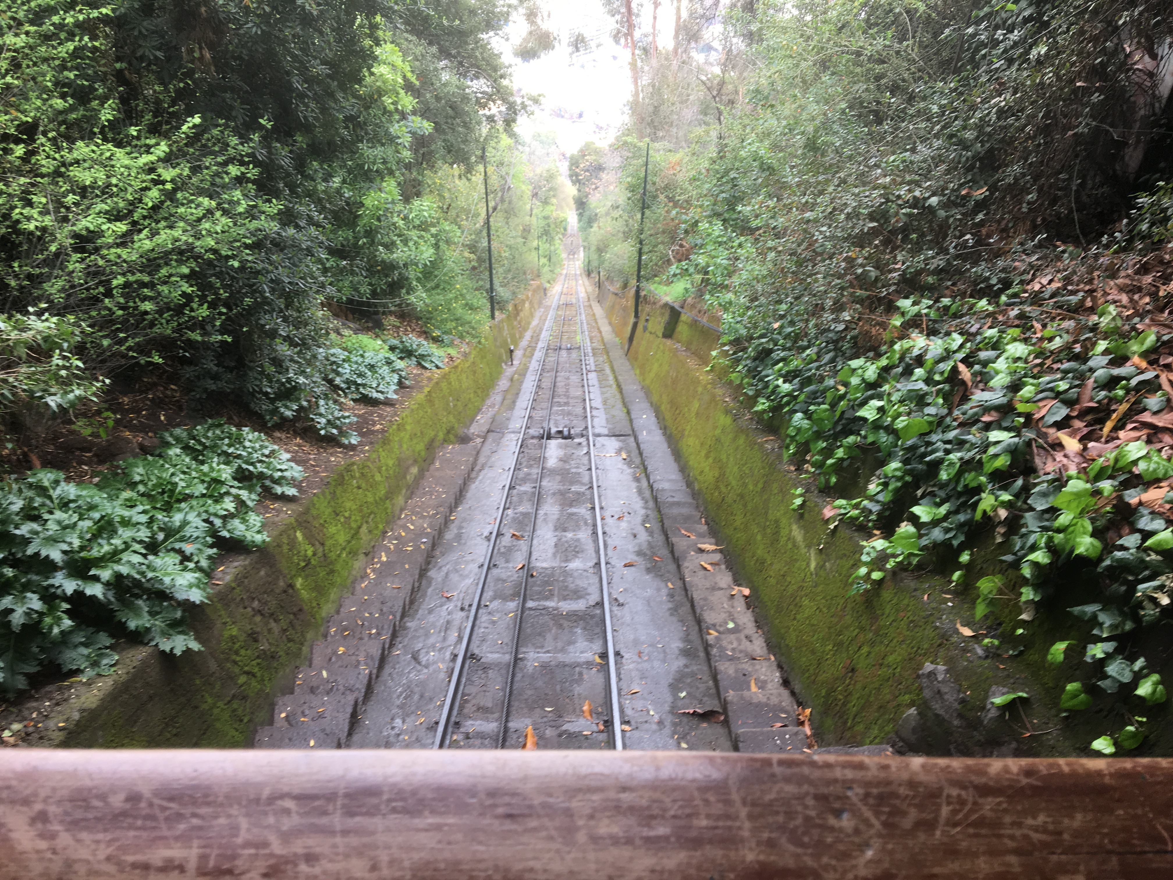
I took the funicular down:
San Cristobal funicular part way down
Having killed the 3 days it was time to pick the bike up. I had questioned the address the freight forwarder had given me as it was not at the airport but seemingly in a suburb about 4 miles away which the guy on reception told me was a “rough area’ – well I’m used to Kidderminster so RAF areas don’t scare me.
Nonetheless, I thought I’d organise a car which proved a wise move. The driver immediately questioned the address but I said that’s what I’ve been given so let’s go there. He was right. We ended up in what can nicely be described as a shanty town but which the mean minded might call a slum. A few phone calls to the UK freight agent produced no joy so I took the driver’s suggestion and we headed for the airport. After one wrong turn we eventually ended up at the right place – slap bang in the middle of the airport. The driver was at my disposal for 3 hours and it was money – about £60 – well spent since my Spanish doesn’t go far.
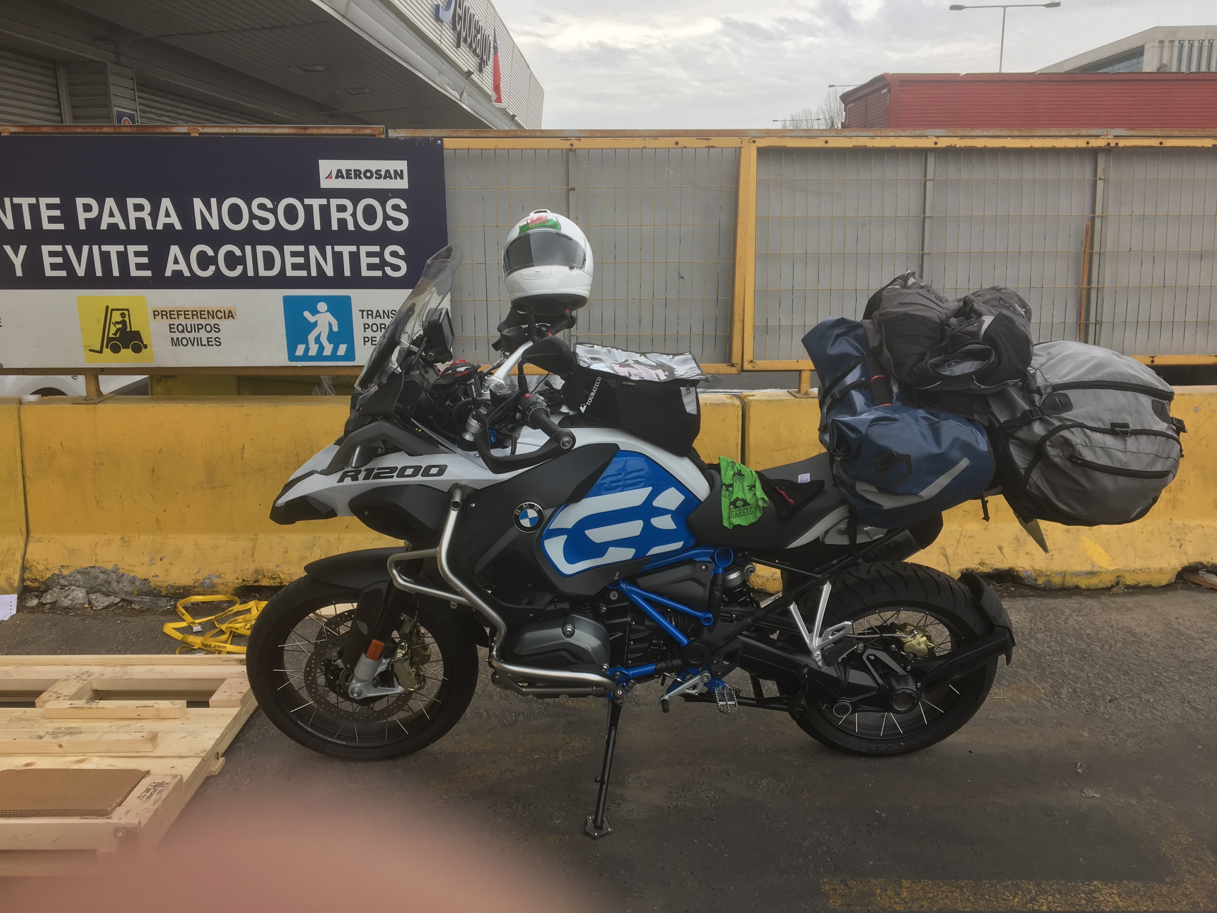
This being Chile you have to be patient but eventually around 1.00pm the crate containing the bike was brought out and put in their car park. Could they please lend me a screwdriver? No was the reply – well F**k you you miserable C**t was my thought. Anyway a chap in the next door warehouse lent us both a screwdriver and a crowbar and a short while later the bike was out of the crate. I had to refit the wing mirrors and windscreen but this didn’t take long and at around 2.00pm I was ready to roll.
The GSA at Santiago Airport, uncrated and ready to go.
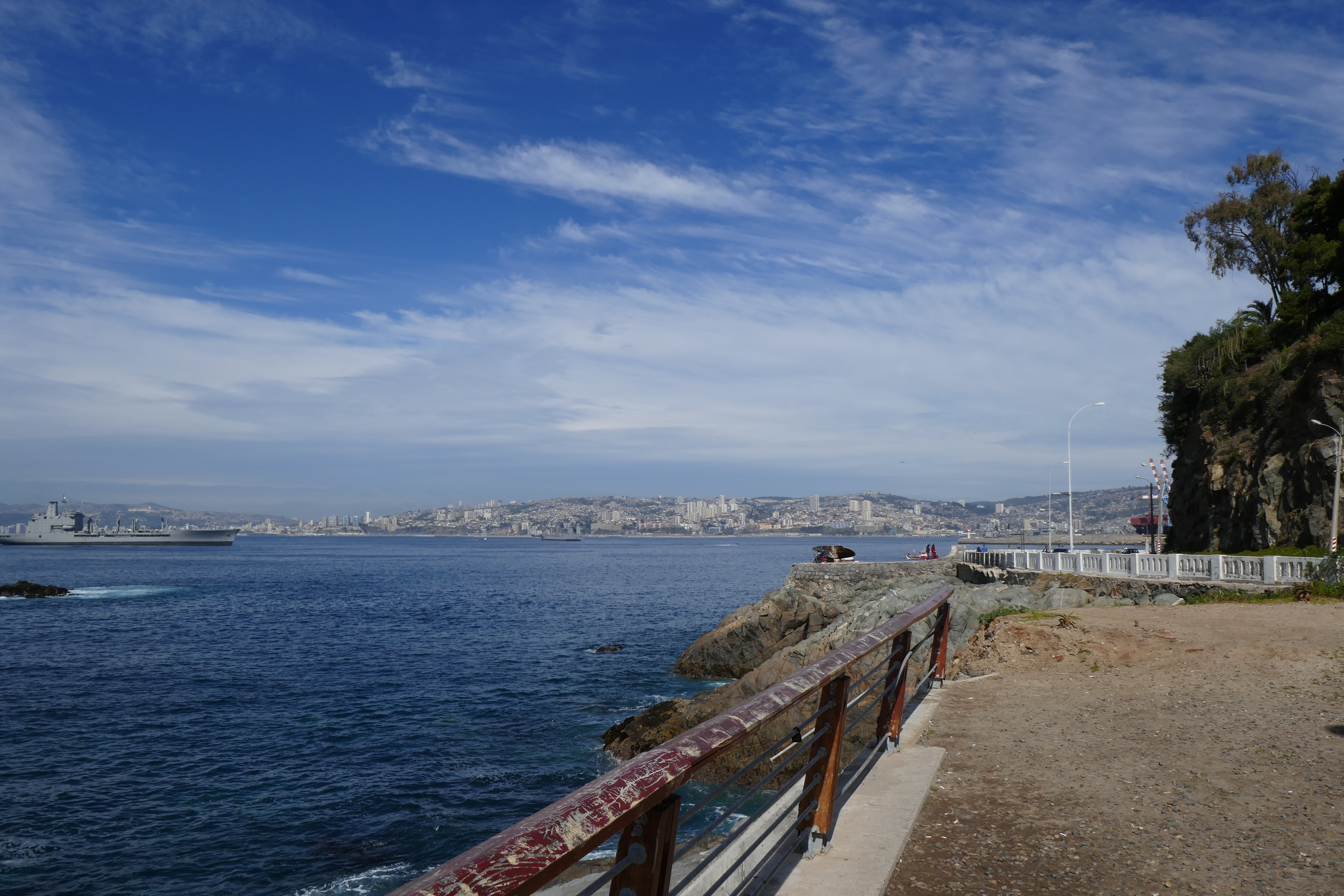
I had booked a hotel in Valparaiso about 60 miles away and it was an easy ride there. I rode up to the headland and took a few shots of the bay:
Valparaiso BayValparaiso Bay with Vina del Mar to the leftValparaiso Bay again
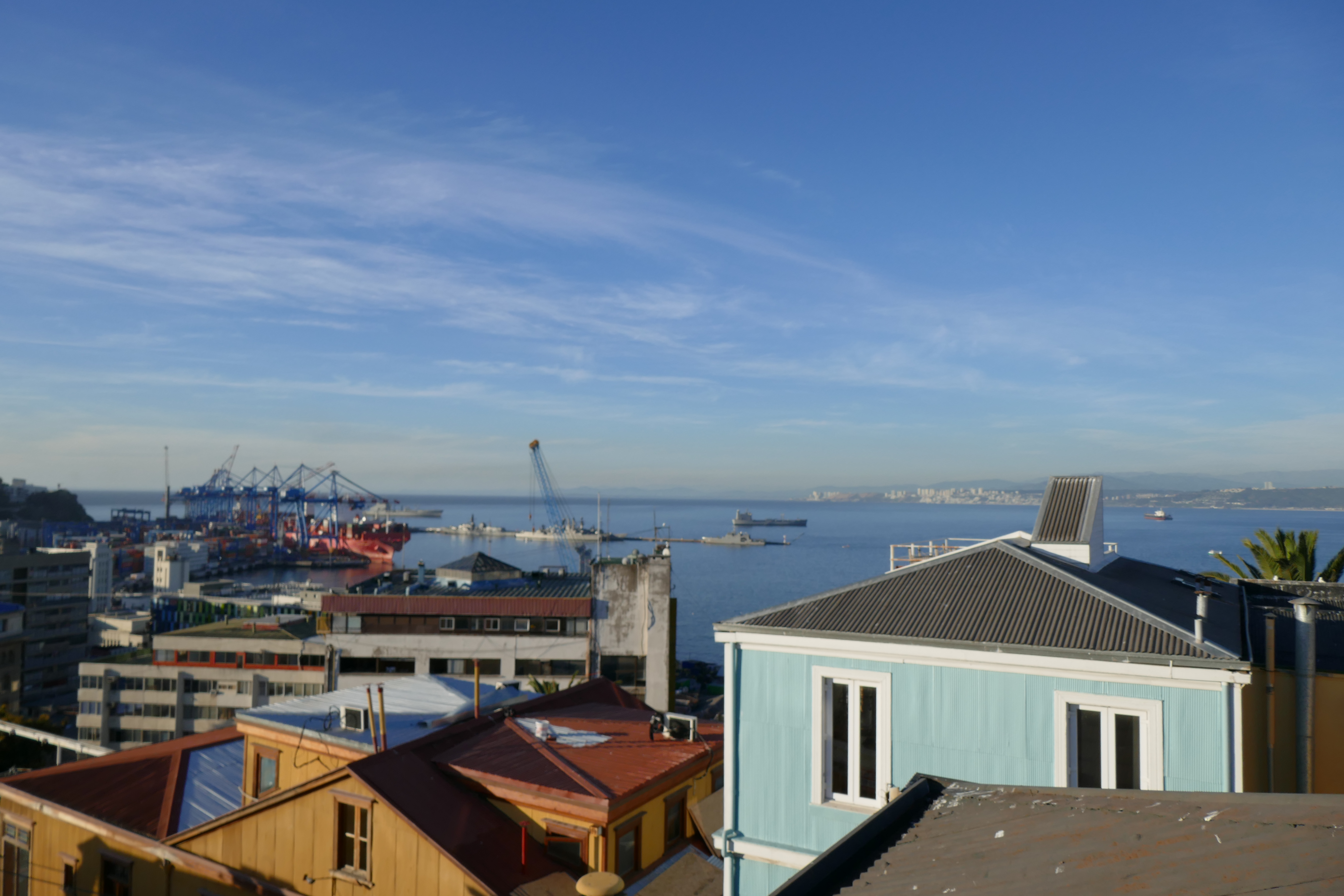
and then I went to find the hotel. This wasn’t that straightforward as the streets are steep – I reckon someone from San Francisco would feel at home here – and there’s a one way system in place – which I ignored on occasion. I found the hotel – the Boutique Hotel Nomada – which was vey nice. You get a good view of the port from the roof terrace:
Valparaiso from the Hotel Nomada
and the señora on reception suggested the restaurant La Concepcion – just down the road – for dinner, which as excellent.
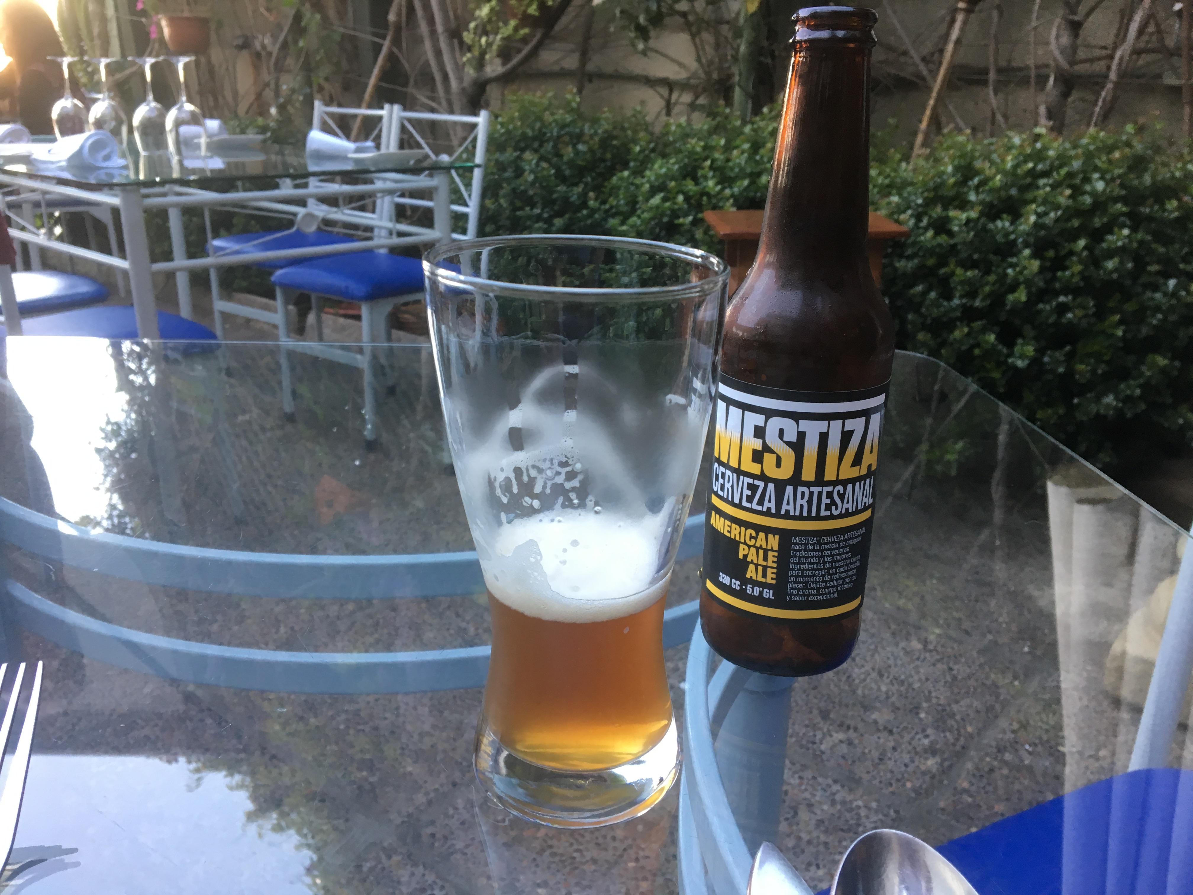
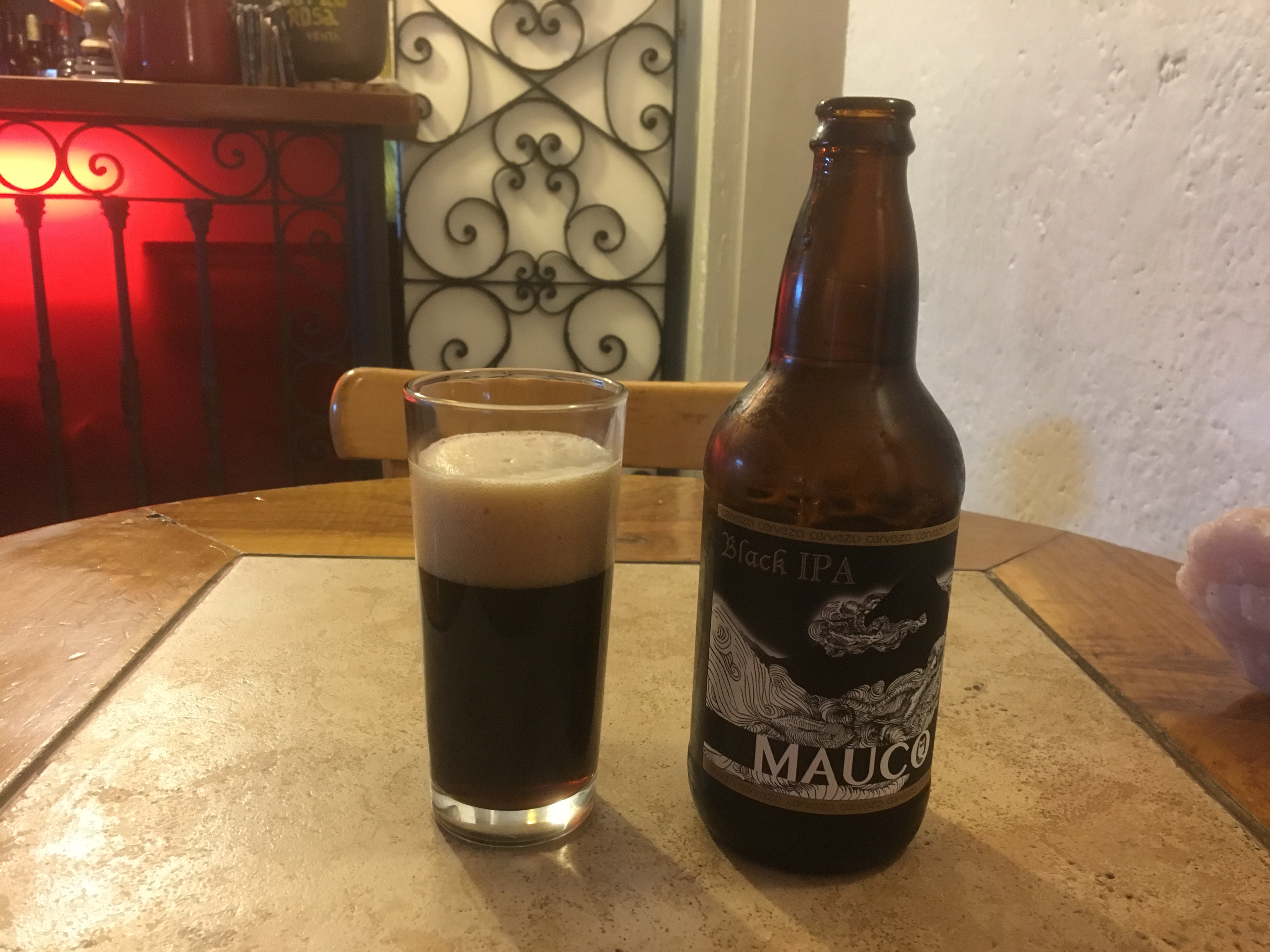
Being a firm believer in the restorative powers of beer I tried a local pale ale which was really good:
Local pale ale at Restaurant La Concepcion in ValparaisoLocal pale ale at Restaurant La Concepcion in Valparaiso
Don’t believe the label when it says “American Pale Ale” – the British invented Pale Ale – and this was too good to have had an American near it. I expect that if Trump reads this post he’ll claim he was responsible for it!
I finished the evening off with another local craft beer:
Local Dark Beer in Valparaiso
which was also really good. You can fault Chilean bureaucracy but they have got the beer thing nailed!
After getting into the apartment yesterday morning and getting cleaned up I ventured out for a stroll. The apartment is in the Lastarria district so only a short distance to downtown Santiago. It reminded me a bit of Porto – there are a few modern skyscrapers but a lot of faded glory. It looks as if the infrastructure hasn’t been well maintained. You would never mistake this for a Northern European city. If it was in Europe it would be in Portugal, Spain or Italy. Quite a bit of poverty in evidence, with a fair few street beggars, but it didn’t feel at all threatening although I suspect that like most cities there are areas best avoided. Anyway a good way to stretch the legs.
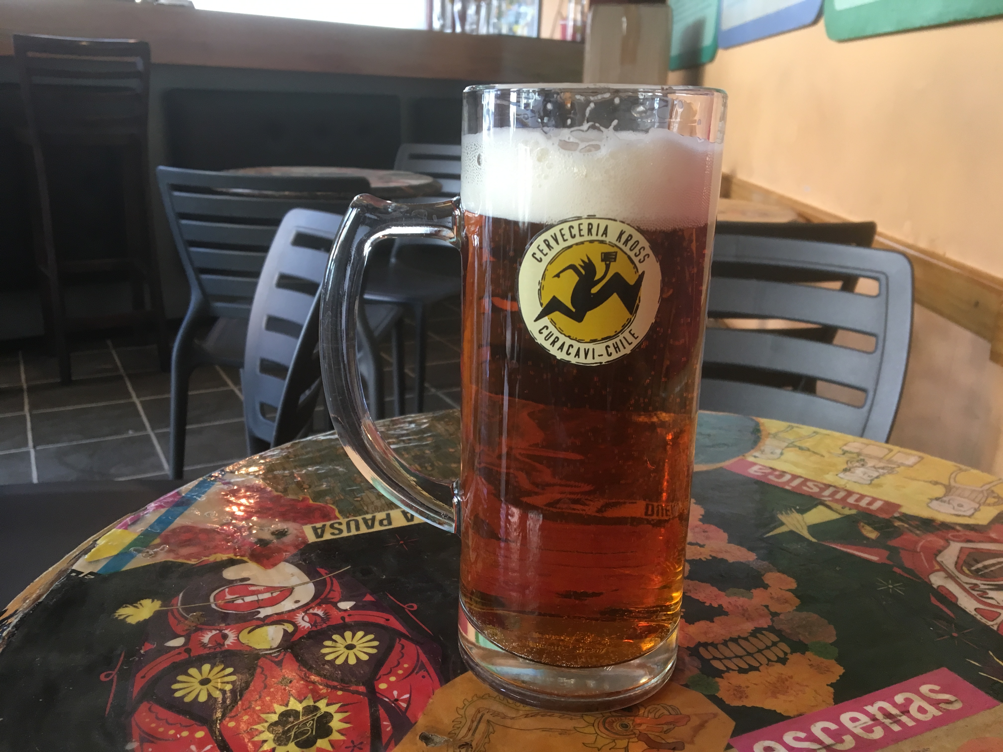
Later on I decided that it was time for a beer. I found a beer bar – no spirits served – called Cafe 200 – a few hundred metres away. This was local Chilean beer called Kroos and very nice it was too.
After a decent nights sleep it was time for some work. I woke up to a message saying that a firm of Irish Solicitors had been trying to contact me without success. Had I given them the right mobile number? Their message was timed at 9.30am Irish time which was 5.30am Chilean time when I was firmly in the land of nod – I had told them where I was and reminded them of the time difference by email the day before – Doh!
So I phoned them, told them that the number was correct, and also told them to agree by email the day before when they were going to call. We shall see whether that works.
After that there were some tasks which needed dealing with. First an email arrived with the Air Waybill for the GSA. This told me that it had arrived on Air Canada but via Toronto which surprised me. The Air Waybill needed printing. After a couple of abortive efforts I eventually located an internet cage where for 100 CP (Chilean Pesos – 790 of them to the Euro – so about 13c or 15p – I got a hard copy to show to the Chilean Customs on Monday morning.
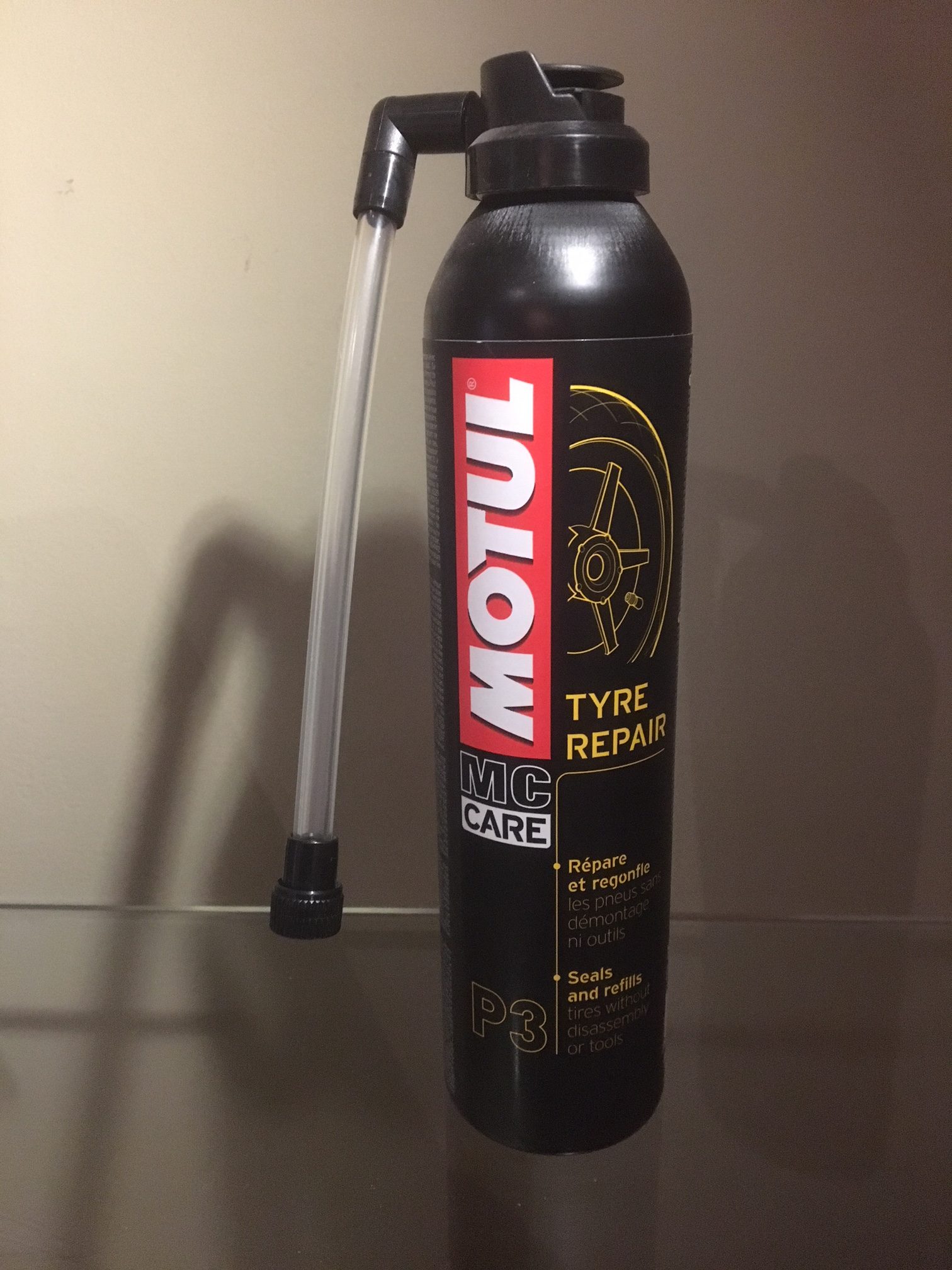
Next up was the need to get a couple of tyre repair kits – the sort that will fix a small puncture by injecting foam into the tyre through the valve. It took a bit of time to locate the right end of the Avenida Lira where the bike shops were and after one unsuccessful foray my next one struck gold as they had Motul kits which will do the job:
Anyway official business over for the day it is time to observe the Chilean Independence celebrations – the party starts this evening and continues until Wednesday. If I get on the bike on Monday I will have to watch out for pissed Chileans!
My motorcycle trip to Chile and Argentina started yesterday with a bus and train ride from Andorra to Lleida to Madrid’s Barajas Airport. I arrived very early for my Iberia flight to Santiago but the bus timetable meant that I ran the risk of cutting it fine if I caught the later bus. So I left Andorra at midday and was through security and in the lounge by about 6.20pm for an 00.10am flight this morning. My Priority Pass would have got me in the lounge anyway but I was flying business class because it’s such a long flight – it took 12.5 hours in the end – that I was prepared to pay the extra for a bit of comfort; that and I had a shedload of air miles to cash in!
Anyway I can handle free wine and beer in any airport lounge with the best of them, so a few drinks, a half decent book and a shower before take-off all meant the time passed swiftly enough.
A ew more drinks on the plane plus a bit to eat and a decent film sent me off for a few hours of reasonable sleep so when we arrived ahead of time I was feeling good. I got through passport control and customs quickly and was at the hotel within an hour and 20 mins of landing.
But by way of background why South America, and in particular Chile and Argentina, for a motorcycle trip. I’ve toured in Europe a lot so fancied a change and in fact I’d not long come back from 9 days in France with Chris and Kyle. I also had a 7 week gap in my schedule free from meetings. I also know many Argentinians, Chileans and Peruvians from Andorra and they seem nice people, and I fancied riding the length of La Cuarenta – Ruta 40 – in Argentina which stretches from La Quiaca on the Bolivian border all the way down to Tierra del Fuego, about 5,000km or 3,200 miles in total.
I have no fixed itinerary other than broadly to ride North from Santiago, cross over to Salta because Argentina are playing Australia at rugby in the 4 Nations championship on September 29th and I fancy seeing the match, and then go up to La Quiaca and start the Ruta 40 bit before heading back to Santiago for the flight back at the end of October. early November.
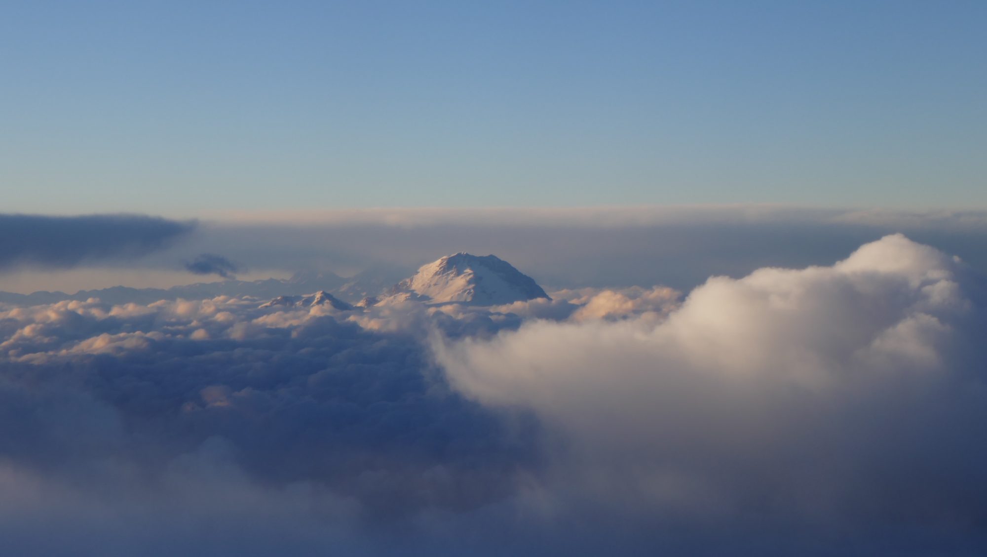
My GSA is scheduled to arrive this Saturday 15th and assuming no hitches I can pick it up on Monday 17th and be on my way. So I’ve a few days to wander round Santiago before starting my ride. There should be plenty of photos and for starters here is one taken from the plane of Mount Aconcagua, which at 6,962 metres or 22,837 feet, is the highest mountain in South America.